Showing 13–24 of 128 results
-

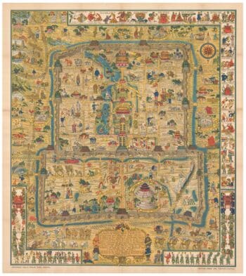
A pictorial map of Beijing in the 1930s
£3,000DORN, Frank.
Published In 1936
Stock No. 24392 -

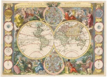
A highly decorative separate-issue world map
£4,500BAILLEUL, Nicolas (le Jeune).
Published In 1750
Stock No. 24097 -

The map of China from the first English atlas of the world
£3,700SPEED, John.
Published In 1665
Stock No. 23978 -

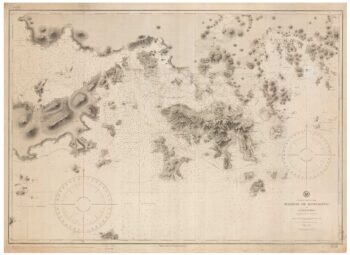
19th century Spanish sea chart of the Yellow Sea and Korea
£2,200BRYANT, Tomas.
Published In 1866
Stock No. 12450 -

A 19th century American sea chart of Hong Kong
£3,500BREWER, H.G.
Published In 1916
Stock No. 23973 -

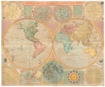
A late 18th century wall map of the world on four sheets
£6,000DUNN, Samuel.
Published In 1799
Stock No. 23965 -

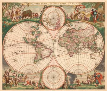
A 17th century Dutch World map with superb decorative borders
£5,500DE WIT, Frederick.
Published In 1670
Stock No. 23590 -

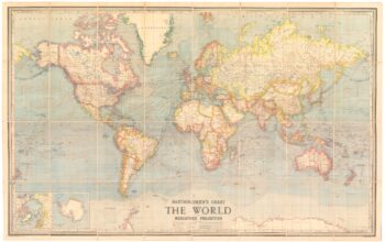
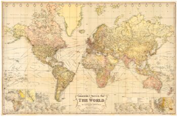
A wall map of the world between the World Wars
£1,500BARTHOLOMEW, John.
Published In 1950
Stock No. 24074 -

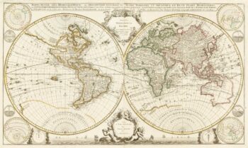
A two-sheet, double-hemisphere world map full of unusual features
£16,000MORTIER, Pierre.
Published In 1700
Stock No. 24058 -

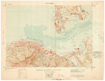
A detailed map of Victoria in the 1930s
£4,500WAR OFFICE.
Published In 1930
Stock No. 23458 -

The British Empire at its height
£950GROSS, Alexander.
Published In 1920
Stock No. 23375 -

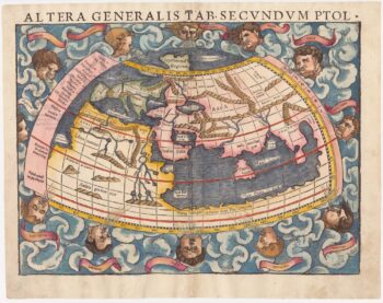
A 16th century woodcut map of the world according to Ptolemy
£1,300MUNSTER, Sebastian.
Published In 1572
Stock No. 24368