Showing 1–12 of 144 results
-

An early woodcut map of Scandinavia
£1,100MUNSTER, Sebastian.
Published In 1572
Stock No. 24567 -

16th century woodblock map of Slovenia and Croatia
£375MUNSTER, Sebastian.
Published In 1572
Stock No. 24581 -
A 16th century woodcut map of Greece
£380MUNSTER, Sebastian.
Published In 1572
Stock No. 24576 -

John Oxley’s mapping of New South Wales
£280HALL, Sidney.
Published In 1828
Stock No. 24519 -

Seven scarce Italian playing cards depicting the Balkans and Greece
£480Anonymous.
Published In 1790
Stock No. 24361 -

A 16th century town plan of Rhodes
£250ROTA, Martin.
Published In 1598
Stock No. 24199 -

A 16th century town plan of Corfu City
£250VALEGIO, Francesco.
Published In 1598
Stock No. 24181 -

A 16th century town plan of Heraklion
£150VALEGIO, Francesco.
Published In 1598
Stock No. 24180 -

A 16th century town plan of Dubrovnik
£250VALEGIO, Francesco.
Published In 1598
Stock No. 24175 -

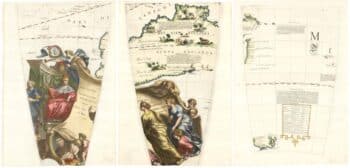
Set of three gores covering Australia from Coronelli’s 42 inch globe
£4,500CORONELLI, Vincenzo Maria.
Published In 1693
Stock No. 23726 -

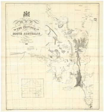
A detailed 19th century survey of South Australia
£950HARRIS, W.G.
Published In 1862
Stock No. 24105 -

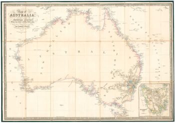
Folding map of Australia with fine colour
£980WYLD, James.
Published In 1833
Stock No. 24071