Showing 13–24 of 93 results
-

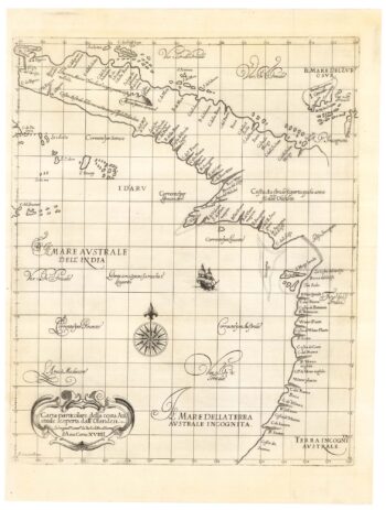
The first map of Australia by an Englishman
£8,500DUDLEY, Robert.
Published In 1646
Stock No. 23777 -

An unusual Italian map of Australia
£650MARMOCCHI, Francesco C.
Published In 1858
Stock No. 23588 -

A mid-19th century map of Victoria marking the gold fields
£150TALLIS, John.
Published In 1851
Stock No. 23543 -

The first published chart of Macquarie Harbour in Tasmania
£1,200DUPERREY, Louis-Isidore.
Published In 1829
Stock No. 23960 -

A 16th century Italian plan of Moscow
£450VALEGIO, Francesco.
Published In 1598
Stock No. 24142 -

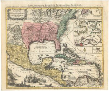
The European colonies in North America in the 18th century
£1,400SEUTTER, Matthaus.
Published In 1735
Stock No. 24089 -

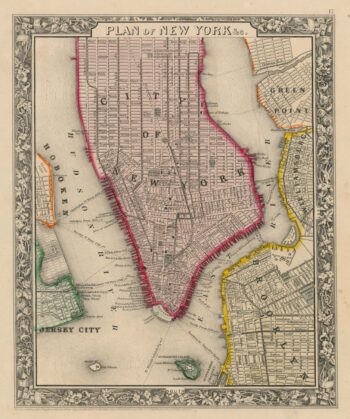
Detailed plan of New York City
£350MITCHELL, Samuel Augustus.
Published In 1860
Stock No. 23834 -

An 18th century map of New South Wales
£320WILKINSON, Robert.
Published In 1794
Stock No. 23692 -

The first published charts of Botany Bay and the Endeavour River
£400COOK, James.
Published In 1773
Stock No. 23669 -

A mid-18th century map of Taiwan
£360BELLIN, Jacques-Nicolas.
Published In 1748
Stock No. 23668 -

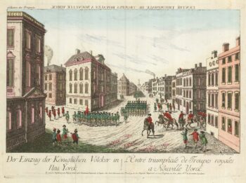
A vue-d’optique of the arrival of General Howe in New York City
£400HABERMANN, Franz Xaver.
Published In 1780
Stock No. 23629 -

Cook’s maps of Botany Bay and the Endeavour River
£180COOK, James.
Published In 1774
Stock No. 23585