Showing 25–36 of 90 results
-

18th century map of New England and New York in original colours
£380BELLIN, Jacques-Nicolas.
Published In 1773
Stock No. 23227 -

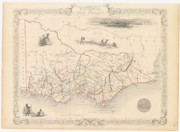
A mid-19th century map of Victoria with decorative vignettes
£150TALLIS, John.
Published In 1851
Stock No. 21787 -

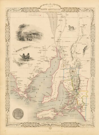
A mid 19th century map of South Australia with decorative vignettes
£160TALLIS, John.
Published In 1851
Stock No. 21600 -

19th century Australia
£300WEILAND, Carl Ferdinand.
Published In 1850
Stock No. 20927 -

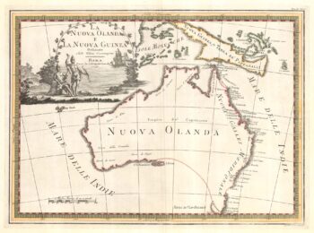
One of the most decorative maps of Australia
£3,750CASSINI, Giovanni Maria.
Published In 1798
Stock No. 17956 -

A mid 19th century map of Western Australia with vignettes
£180TALLIS, John.
Published In 1851
Stock No. 21789 -

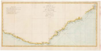
Captain Cook’s map of New South Wales
£950COOK, James.
Published In 1774
Stock No. 20274 -
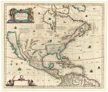
The first issue of an important map of North America
£6,500HONDIUS, Henricus.
Published In 1636
Stock No. 22862 -

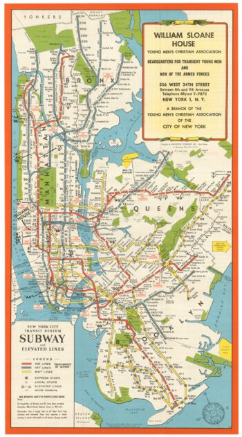
A tourist’s map of New York’s Subway system in the 1950s
£250HAGSTROM COMPANY INC.
Published In 1951
Stock No. 22810 -

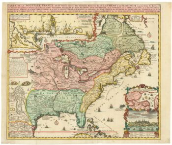
A map of North America during the Mississippi Bubble
£2,400CHATELAIN, Henri Abraham.
Published In 1718
Stock No. 22751 -

A bibliography and biography of Hollar, extra-illustrated with original etchings
£6,500VERTUE, George.
Published In 1745
Stock No. 22727 -

The illustration that introduced the Kangaroo to the British public
£700STUBBS, George.
Published In 1773
Stock No. 22975