Showing 1–12 of 24 results
-

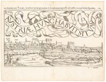
A 16th century town plan of Vienna
£200VALEGIO, Francesco.
Published In 1598
Stock No. 24172 -

A late-18th century plan of Vienna
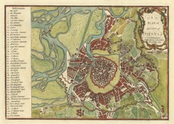
£230ANDREWS, John.
Published In 1800
Stock No. 24512 -

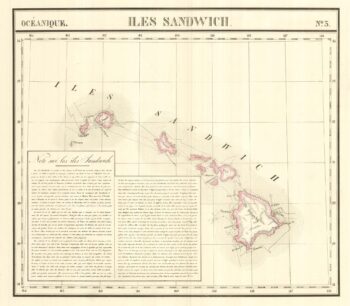
The largest representation of Hawaii to appear in an atlas
£900VANDERMAELEN, Philippe.
Published In 1827
Stock No. 24396 -

18th century illustration of a sundial
£160THOMAS, Corbinianus.
Published In 1730
Stock No. 21490 -

A 17th century illustration of an armillary sphere
£180MALLET, Alain Manesson.
Published In 1683
Stock No. 23928 -

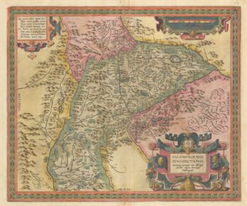
Ortelius’s map of the province of Salzburg, in fine colour
£600ORTELIUS, Abraham.
Published In 1612
Stock No. 23808 -

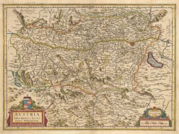
A 17th century map of Austria
£350HONDIUS, Jodocus II.
Published In 1635
Stock No. 23746 -
Mid 19th century map of Austria and the Habsburg Empire
£160TALLIS, John.
Published In 1851
Stock No. 23497 -

An 18th century illustration of an armillary sphere
£950DESNOS, Louis Charles.
Published In 1781
Stock No. 23289 -

A 17th century map of Austria
£400JANSSON, Jan.
Published In 1650
Stock No. 20320 -

A two-sheet woodcut prospect of Vienna in the 16th century
£550MUNSTER, Sebastian.
Published In 1548
Stock No. 22492 -
A view of La Pérouse’s expedition at anchor off Maui
£400BLONDELA, Francois Michel.
Published In 1797
Stock No. 22416