Showing 1–12 of 92 results
-

Vrients’s scarce map of England, Wales & Ireland
£4,250VRIENTS, Jan Baptist.
Published In 1612
Stock No. 20271 -

A scarce two-sheet map of England and Wales with side panels
£3,000WILLDEY, George.
Published In 1715
Stock No. 24165 -

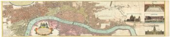
The English edition of the earliest available printed map of London
£2,800BRAUN, Georg & HOGENBERG, Frans.
Published In 1708
Stock No. 24162 -

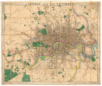
A very scarce handkerchief map of London
£2,800Anonymous.
Published In 1832
Stock No. 20799 -

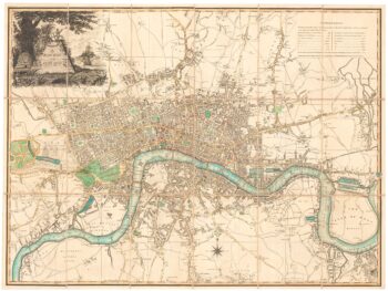
An 18th century two-sheet plan of London
£3,800FOSTER, George.
Published In 1778
Stock No. 18487 -
A fine 19th century wall map of London
£4,800WYLD, James.
Published In 1875
Stock No. 23579 -

A fine three-sheet map of Georgian London
£4,000HOMANN HEIRS.
Published In 1736
Stock No. 22757 -

Large scale town plan of Victorian London
£1,000WYLD, James.
Published In 1869
Stock No. 24117 -

A large plan of London in 1863
£1,600OUTHETT, John.
Published In 1863
Stock No. 24116 -

An unrecorded state of an early 19th century plan of London
£1,900LAURIE & WHITTLE.
Published In 1800
Stock No. 23944 -

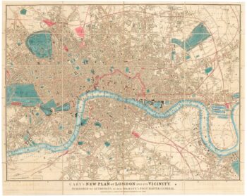
Detailed map of London during the Great Exhibition of 1851
£1,400CARY, John.
Published In 1851
Stock No. 23829 -

The famous ‘Wonderground’ map of London
£3,250GILL, Leslie MacDonald.
Published In 1924
Stock No. 23780