Showing 1–12 of 23 results
-

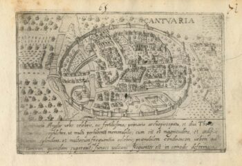
A 16th century Italian plan of Canterbury
£280VALEGIO, Francesco.
Published In 1598
Stock No. 24131 -

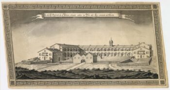
A very fine 18th century sketch of the Royal Naval Hospital. Mahon
£1,250Anonymous.
Published In 1790
Stock No. 23964 -

Very fine 18th century manuscript chart of Mahon
£1,750Anonymous.
Published In 1790
Stock No. 23904 -

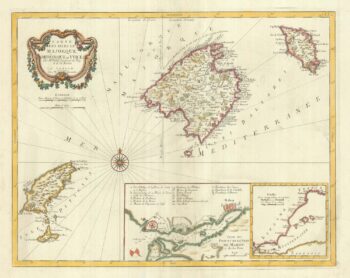
Maps of Minorca and Mahon at the end of the Seven Years’ War
£450Anonymous.
Published In 1763
Stock No. 24052 -

A 16th century map of Minorca
£180PORCACCHI, Tomaso.
Published In 1590
Stock No. 23211 -

Detailed 18th century map of the Balearics
£650SANTINI, Francesco & SANTINI, Paolo.
Published In 1784
Stock No. 20247 -

An early example of Seutter’s map of the Balearics
£980SEUTTER, Matthaus.
Published In 1741
Stock No. 23095 -

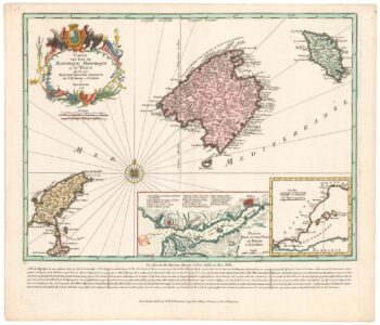
Map of the Balearics during the Seven Years’ War
£850SEUTTER, Matthaus.
Published In 1760
Stock No. 22960 -

A 17th century townplan of Dover
£120HERMANNIDES, Rutger.
Published In 1661
Stock No. 22789 -
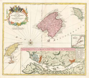
The Balearics with an inset chart of Mahon Harbour
£950LOTTER, Tobias Conrad.
Published In 1760
Stock No. 22199 -

Early bird’s-eye map-view of Canterbury
£900BRAUN, Georg & HOGENBERG, Frans.
Published In 1588
Stock No. 22168 -

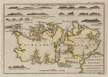
18th century map of the Falkland Islands
£100LODGE, John.
Published In 1770
Stock No. 22014