Showing 25–36 of 163 results
-

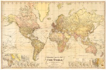
The British Empire at its height
£950GROSS, Alexander.
Published In 1920
Stock No. 23375 -

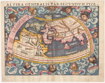
A 16th century woodcut map of the world according to Ptolemy
£1,300MUNSTER, Sebastian.
Published In 1572
Stock No. 24368 -

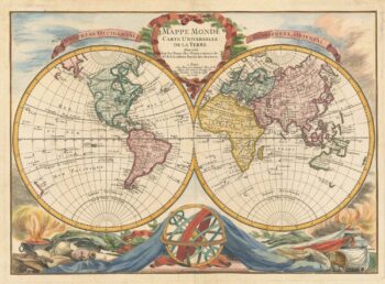
18th century double-hemisphere world map with celestial insets
£2,200HOMANN, Johann Baptist.
Published In 1720
Stock No. 24164 -

A separate-issue map of the route from England to China for the East India Company
£2,500WALKER, John.
Published In 1829
Stock No. 23958 -

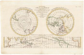
A scarce 18th century double-hemisphere world map
£1,200BOURGOIN, Pierre.
Published In 1766
Stock No. 22916 -

Rare three-part world map from the first American rncyclopedia
£240BARKER, William.
Published In 1793
Stock No. 24083 -

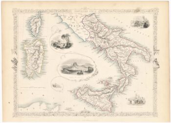
Mid-19th century map of southern Italy with vignettes
£125TALLIS, John.
Published In 1851
Stock No. 23547 -

The first atlas map of the world to show California as an island
£12,500SPEED, John.
Published In 1676
Stock No. 23983 -

18th century town plan of Peking
£450HARRIS, John.
Published In 1748
Stock No. 23674 -

A rare map of the Kingdom of Naples
£680NOLIN, Jean Baptiste.
Published In 1705
Stock No. 23637 -

A 16th century Italian plan of Hangzhou
£650VALEGIO, Francesco.
Published In 1598
Stock No. 24153 -

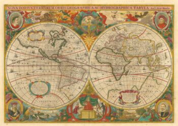
‘A fine ornate example of the decorative cartography of the time’
£8,000HONDIUS, Henricus.
Published In 1641
Stock No. 24127