Showing 1–12 of 97 results
-

A 16th century woodcut map of Poland, Lithuania and Hungary
£700MUNSTER, Sebastian.
Published In 1572
Stock No. 24574 -

A scarce 18th century map of the Polish-Lithuanian Commonwealth
£950NOLIN, Jean Baptiste jnr.
Published In 1742
Stock No. 24544 -

A 17th century map of Poland
£750DE ROSSI, Giovanni Giacomo.
Published In 1685
Stock No. 24518 -

Four scarce Italian playing cards depicting Poland
£850Anonymous.
Published In 1790
Stock No. 24241 -

16th century woodblock map of Silesia
£300MUNSTER, Sebastian.
Published In 1572
Stock No. 24582 -

16th century woodblock map of Slovenia and Croatia
£375MUNSTER, Sebastian.
Published In 1572
Stock No. 24581 -

Seven scarce Italian playing cards depicting the Balkans and Greece
£480Anonymous.
Published In 1790
Stock No. 24361 -

A 16th century town plan of Dubrovnik
£250VALEGIO, Francesco.
Published In 1598
Stock No. 24175 -

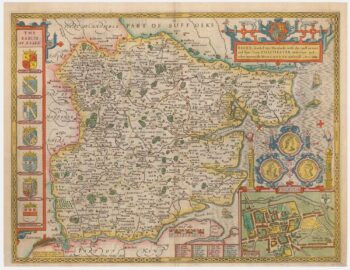
A scarce issue of John Speed’s map of Essex
£950SPEED, John.
Published In 1665
Stock No. 24044 -

A map of Essex published during the English Civil War
£650BLAEU, Johannes.
Published In 1646
Stock No. 23924 -

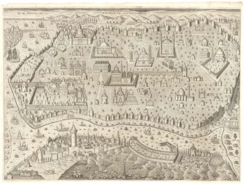
An unusual 17th century plan of Constantinople
£1,200ISAAC, Jaspar.
Published In 1624
Stock No. 23738 -

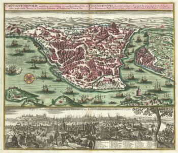
An 18th century town plan and prospect of Constantinople
£2,000SEUTTER, Matthaus.
Published In 1735
Stock No. 23453