Showing all 10 results
-

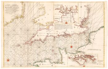
A monumental sea chart of south-west England
£3,250HOOGHE, Romeyn de.
Published In 1693
Stock No. 24483 -

A rare 17th century Dutch sea chart of the British Isles
£1,400DONCKER, Hendrik.
Published In 1665
Stock No. 22272 -

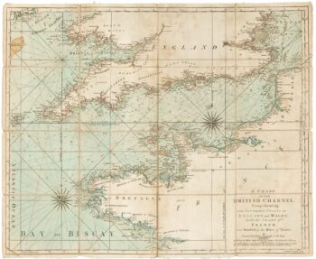
An 18th century two-sheet sea chart of the English Channel based on Halley
£1,250MOUNT & PAGE.
Published In 1745
Stock No. 23424 -
An 18th century sea chart of the English Channel
£450JEFFERYS, Thomas.
Published In 1775
Stock No. 23417 -

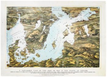
A map-view of the Baltic Sea during the Crimean War
£750READ & Co.
Published In 1855
Stock No. 20828 -

A sea chart of the Gulf of Finland published the year of Waterloo
£1,000Dépôt des Cartes et Plans de la Marine.
Published In 1815
Stock No. 18865 -

Mid 19th century map of the Baltic Sea
£100TALLIS, John.
Published In 1860
Stock No. 18556 -
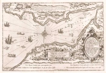
Waghenaer’s distinctive sea chart of the Bristol Channel
£2,200WAGHENAER, Lucas Janzoon.
Published In 1591
Stock No. 18369 -

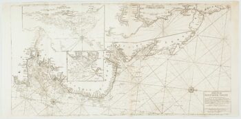
An important chart of the east coasts of England
£650MOUNT & PAGE.
Published In 1747
Stock No. 15582 -

A pictorial map of the Baltic theatre of the Crimean War
£325ILLUSTRATED LONDON NEWS.
Published In 1856
Stock No. 10369