Showing all 10 results
-

A large scale map of Leicestershire in fine colour
£2,200GREENWOOD, C. & J.
Published In 1826
Stock No. 24064 -

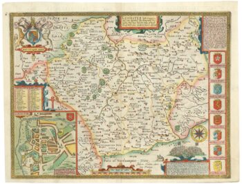
A scarce issue of John Speed’s map of Leicestershire
£700SPEED, John.
Published In 1665
Stock No. 24021 -

The Speed map of England’s colony of Carolina
£4,000SPEED, John.
Published In 1676
Stock No. 23796 -

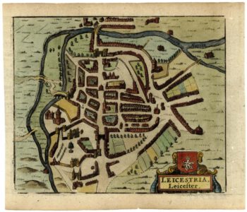
A 17th century townplan of Leicester
£130HERMANNIDES, Rutger.
Published In 1661
Stock No. 22769 -

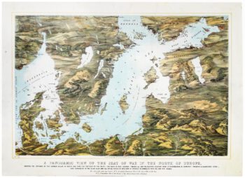
A map-view of the Baltic Sea during the Crimean War
£750READ & Co.
Published In 1855
Stock No. 20828 -

A sea chart of the Gulf of Finland published the year of Waterloo
£1,000Dépôt des Cartes et Plans de la Marine.
Published In 1815
Stock No. 18865 -

Mid 19th century map of the Baltic Sea
£100TALLIS, John.
Published In 1860
Stock No. 18556 -

Early English chart of Carolina
£3,800THORNTON, John.
Published In 1748
Stock No. 15471 -

An uncommon Spanish sea chart of North Carolina
£2,000DE LORENZO, J.
Published In 1868
Stock No. 11861 -

A pictorial map of the Baltic theatre of the Crimean War
£325ILLUSTRATED LONDON NEWS.
Published In 1856
Stock No. 10369