Showing 1–12 of 149 results
-

A 16th century woodcut map of Poland, Lithuania and Hungary
£700MUNSTER, Sebastian.
Published In 1572
Stock No. 24574 -

18th century map of the Eastern Seaboard
£750ROBERT DE VAUGONDY, Didier.
Published In 1770
Stock No. 24555 -

A scarce 18th century map of the Polish-Lithuanian Commonwealth
£950NOLIN, Jean Baptiste jnr.
Published In 1742
Stock No. 24544 -

A 17th century map of Poland
£750DE ROSSI, Giovanni Giacomo.
Published In 1685
Stock No. 24518 -

Four scarce Italian playing cards depicting Poland
£850Anonymous.
Published In 1790
Stock No. 24241 -

The Russo-Turkish War in the Ukraine, 1735-39
£1,500OTTENS, Reinier & Joshua.
Published In 1736
Stock No. 24618 -

16th century woodblock map of Silesia
£300MUNSTER, Sebastian.
Published In 1572
Stock No. 24582 -

Seven scarce Italian playing cards depicting Russia
£480Anonymous.
Published In 1790
Stock No. 24360 -

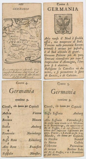
Four scarce Italian playing cards depicting Germany
£280Anonymous.
Published In 1790
Stock No. 24244 -

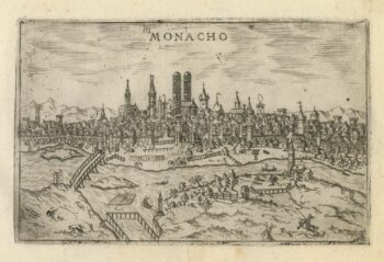
A 16th century Italian plan of Munich
£260VALEGIO, Francesco.
Published In 1598
Stock No. 24143 -
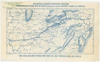
An advert for an American railway
£750Anonymous.
Published In 1865
Stock No. 24455 -
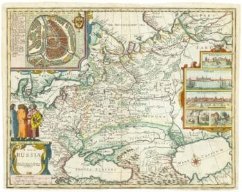
Russia, from the first English atlas of the World
£2,200SPEED, John.
Published In 1676
Stock No. 23731