Showing 37–48 of 150 results
-

Map of Peru and Bolivia with vignette scenes
£140TALLIS, John.
Published In 1851
Stock No. 23528 -

Mid 19th century map of Austria and the Habsburg Empire
£160TALLIS, John.
Published In 1851
Stock No. 23497 -

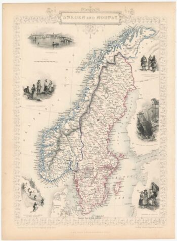
Decorative map of Sweden and Norway
£160TALLIS, John.
Published In 1851
Stock No. 23485 -

Early 17th century map of Iceland in fabulous early colour
£1,800MERCATOR, Gerard.
Published In 1608
Stock No. 23475 -

The Muscovy Company whaling at Svalbard
£950EDGE, Thomas.
Published In 1625
Stock No. 23464 -

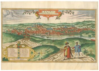
A 16th century prospect of Krakow from the ‘Civitates Orbis Terrarum’
£2,400BRAUN, Georg & HOGENBERG, Frans.
Published In 1617
Stock No. 23345 -

The famous sea-monsters map of Iceland
£13,500ORTELIUS, Abraham.
Published In 1595
Stock No. 23343 -

An 17th century map of the Kingdom of Hungary
£450DE WIT, Frederick.
Published In 1688
Stock No. 23292 -

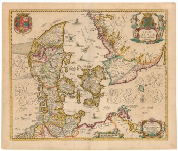
A separately-issued map of Denmark, the earliest dated map by de Wit
£750DE WIT, Frederick.
Published In 1659
Stock No. 23255 -

One of the few early map focusing on Norway
£850DE WIT, Frederick.
Published In 1680
Stock No. 23247 -

An incunable ‘view’ of Poland
£650SCHEDEL, D. Hartmann.
Published In 1493
Stock No. 23232 -

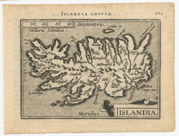
The scarce second Galle plate for Iceland used in the ‘Epitome’
£600ORTELIUS, Abraham.
Published In 1598
Stock No. 23194