Showing 1–12 of 64 results
-

17th century map of the Sun
£1,850KIRCHER, Athanasius.
Published In 1665
Stock No. 24606 -

A 16th century town plan of Bruges
£240VALEGIO, Francesco.
Published In 1598
Stock No. 24204 -

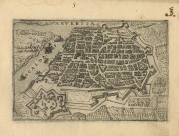
A 16th century town plan of Antwerp
£250VALEGIO, Francesco.
Published In 1598
Stock No. 24203 -

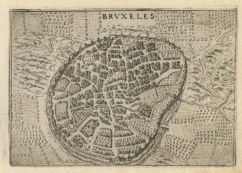
A 16th century town plan of Brussels
£250VALEGIO, Francesco.
Published In 1598
Stock No. 24202 -

Mid 19th century map of Belgium with decorative vignettes
£120TALLIS, John.
Published In 1851
Stock No. 21637 -

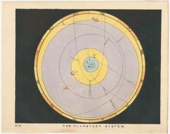
Chart of the Planetary System
£175BLUNT, Charles F.
Published In 1845
Stock No. 24250 -

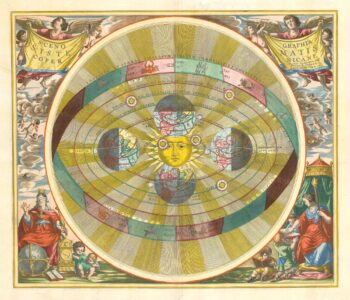
The iconic depiction of the Copernican solar system
£5,000CELLARIUS, Andreas.
Published In 1708
Stock No. 24383 -

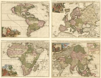
Van der Aa’s large format maps of the four Continents in superb colour
£7,500AA, Pieter van der.
Published In 1713
Stock No. 24369 -

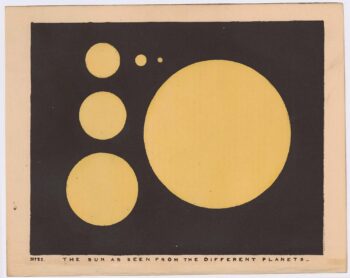
Chart of the Sun
£175BLUNT, Charles F.
Published In 1845
Stock No. 24357 -
An illustration of the origin of the Asteroids
£175BLUNT, Charles F.
Published In 1845
Stock No. 24328 -

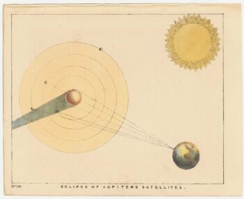
A 19th century illustration of the eclipsing of Jupiter’s Satellites
£175BLUNT, Charles F.
Published In 1845
Stock No. 24318 -

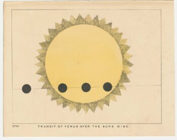
A 19th century chart of the transit of Venus across the Sun.
£175BLUNT, Charles F.
Published In 1845
Stock No. 24317