Showing 337–348 of 371 results
-

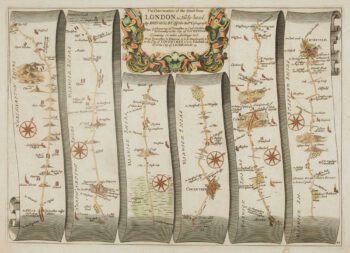
Early map of the roads from Towcester to Lichfield
£230OGILBY, John.
Published In 1675
Stock No. 15088 -

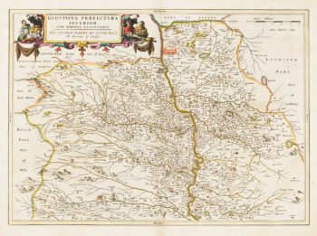
Map of Lower Clydesdale & the environs of Glasgow from the first atlas of Scotland
£380PONT, Timothy.
Published In 1654
Stock No. 14625 -
Map of Renfrewshire from the first atlas of Scotland
£350PONT, Timothy.
Published In 1662
Stock No. 14624 -

17th century map of Middlesex & Hertfordshire
£850JANSSON, Jan.
Published In 1710
Stock No. 14617 -

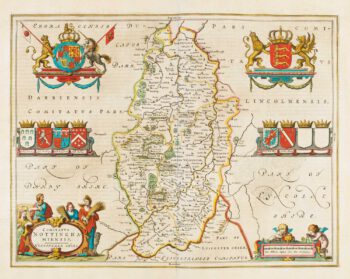
Map of Nottinghamshire published during the English Civil War
£500BLAEU, Johannes.
Published In 1648
Stock No. 14532 -

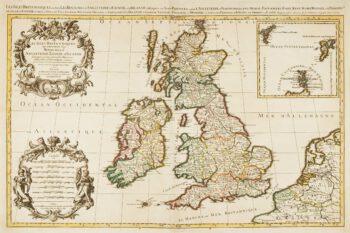
17th century map of the British Isles on two sheets
£1,200JAILLOT, Alexis-Hubert.
Published In 1696
Stock No. 14463 -

Map of the Cardiganshire, Montgomeryshire and Radnorshire from Drayton’s fantastical ‘Poly-Olbion’
£250DRAYTON, Michael.
Published In 1612
Stock No. 14049 -

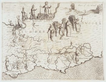
Map of Surrey and Sussex from Drayton’s fantastical ‘Poly-Olbion’
£450DRAYTON, Michael.
Published In 1612
Stock No. 14044 -

Map of Middlesex and Hertfordshire from Drayton’s fantastical ‘Poly-Olbion’
£400DRAYTON, Michael.
Published In 1612
Stock No. 14043 -

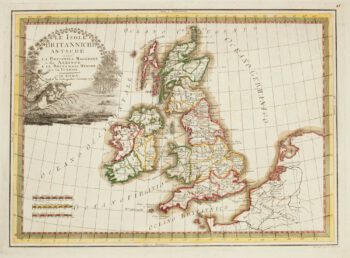
A map of the British Isles in ancient times
£300CASSINI, Giovanni Maria.
Published In 1799
Stock No. 13868 -

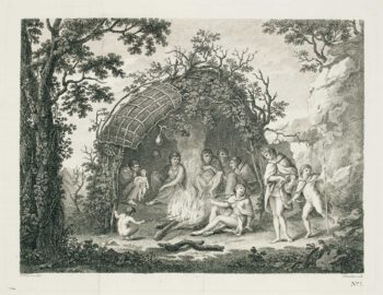
View of Tierra del Fuego from Cook’s First Voyage
£70CIPRIANI, Giovanni Battista.
Published In 1773
Stock No. 13793 -

Detailed chart of the approaches to Harwich Harbour
£400BURN, George.
Published In 1794
Stock No. 13254