Showing all 7 results
-

A scarce edition of Speed’s map of County Durham
£600SPEED, John.
Published In 1665
Stock No. 23820 -

Saxton’s map of Durham as revised by Philip Lea
£1,250SAXTON, Christopher.
Published In 1694
Stock No. 22702 -

The first printed map of County Durham
£3,000SAXTON, Christopher.
Published In 1579
Stock No. 22583 -

18th century map of the Falkland Islands
£100LODGE, John.
Published In 1770
Stock No. 22014 -

Early chart of the Falkland Islands
£130NOUAL, Isaac.
Published In 1773
Stock No. 17278 -

One of the most decorative maps of Bermuda
£2,000ZATTA, Antonio.
Published In 1778
Stock No. 16570 -

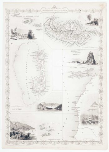
Map of Bermuda and other islands in the Atlantic, with vignettes
£100TALLIS, John.
Published In 1851
Stock No. 12631