Showing 1–12 of 74 results
-
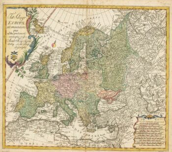
18th century map of Europe
£440EULER, Leonhard.
Published In 1760
Stock No. 24111 -

First issue of Rumold Mercator’s map of Europe
£2,500MERCATOR, Rumold.
Published In 1595
Stock No. 24298 -

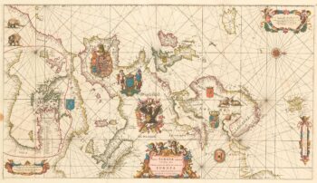
An exceptional 17th century sea chart of Europe on two sheets
£7,500DE WIT, Frederick.
Published In 1675
Stock No. 23450 -

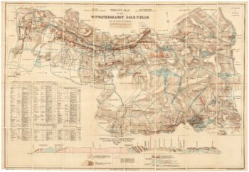
A scarce map of the gold rush near Johannesburg
£1,900TROYE, Gustav Arthur.
Published In 1892
Stock No. 24104 -

A two-sheet map of Europe
£1,000JAILLOT, Alexis-Hubert.
Published In 1705
Stock No. 24059 -

A very scarce Italian playing card of South America
£450Anonymous.
Published In 1790
Stock No. 24230 -

Decorative 18th century map of Norway
£460HOMANN, Johann Baptist.
Published In 1720
Stock No. 24171 -

Cape of Good Hope naval prospect
£400AA, Pieter van der.
Published In 1719
Stock No. 24077 -

A 17th century map of the Roman Empire
£1,600SPEED, John.
Published In 1627
Stock No. 23989 -

17th century English carte ? figure map of Europe
£2,600SPEED, John.
Published In 1665
Stock No. 23986 -

18th century vue d’optique of the Cape of Good Hope
£600RIEDEL, Gottlieb Friedrich.
Published In 1780
Stock No. 23736 -

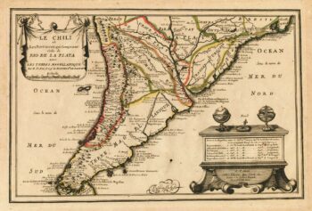
Map of Southern South America
£220FER, Nicolas de.
Published In 1702
Stock No. 23712