Showing 1–12 of 103 results
-
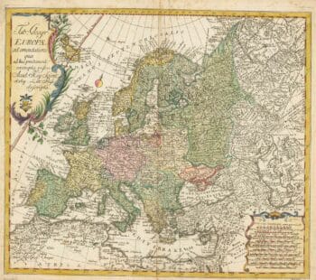
18th century map of Europe
£440EULER, Leonhard.
Published In 1760
Stock No. 24111 -

An incunable prospect of Prague
£1,450SCHEDEL, D. Hartmann.
Published In 1493
Stock No. 24451 -

A two-sheet map of North America
£2,950JAILLOT, Alexis-Hubert.
Published In 1705
Stock No. 24062 -

A two-sheet map of North America
£2,250JAILLOT, Alexis-Hubert.
Published In 1674
Stock No. 24482 -

First issue of Rumold Mercator’s map of Europe
£2,500MERCATOR, Rumold.
Published In 1595
Stock No. 24298 -

A rare Italian edition of Hennepin’s landmark map of Louisiana
£2,800HENNEPIN, Louis.
Published In 1691
Stock No. 24027 -

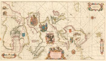
An exceptional 17th century sea chart of Europe on two sheets
£7,500DE WIT, Frederick.
Published In 1675
Stock No. 23450 -

A two-sheet map of Europe
£1,000JAILLOT, Alexis-Hubert.
Published In 1705
Stock No. 24059 -

A large four-sheet map of Midlothian
£750KNOX, James.
Published In 1821
Stock No. 23326 -

A Georgian folding map of Linlithgowshire
£800FORREST, William.
Published In 1818
Stock No. 22680 -

Decorative 18th century map of Norway
£460HOMANN, Johann Baptist.
Published In 1720
Stock No. 24171 -

A rare issue of Speed’s map of the West Riding of Yorkshire
£1,400SPEED, John.
Published In 1665
Stock No. 24004