Showing 1–12 of 22 results
-

Munster’s map of northern Europe after Ortelius
£750MUNSTER, Sebastian.
Published In 1514
Stock No. 24585 -

A 16th century town plan of Toledo
£250VALEGIO, Francesco.
Published In 1598
Stock No. 24189 -

A 16th century town plan of Santander
£260VALEGIO, Francesco.
Published In 1598
Stock No. 24188 -

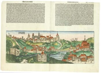
An incunable prospect of Prague
£1,450SCHEDEL, D. Hartmann.
Published In 1493
Stock No. 24451 -

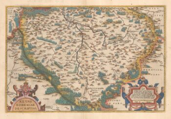
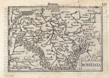
16th century Dutch map of Bohemia
£400ORTELIUS, Abraham.
Published In 1584
Stock No. 23874 -

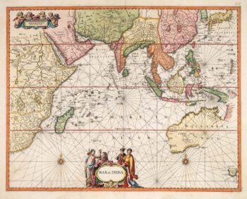
The Indian Ocean from Ortelius’s ”Parergon”
£950ORTELIUS, Abraham.
Published In 1608
Stock No. 23719 -

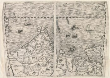
Important 16th century ‘Upside-Down’ map of the Indian Ocean
£9,500GASTALDI, Giacomo.
Published In 1565
Stock No. 22851 -

A Dutch chart of the Indian Ocean with Australia
£2,000JANSSON, Jan.
Published In 1650
Stock No. 23581 -

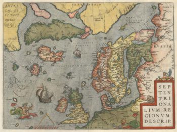
The famous Ortelius map of the northern Atlantic regions
£2,250ORTELIUS, Abraham.
Published In 1612
Stock No. 22499 -
A 16th century miniature map of Bohemia
£110LANGENES, Barent.
Published In 1599
Stock No. 21309 -
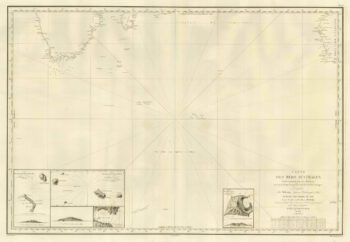
The Southern Indian Ocean with early Antarctic discoveries
£400DAUSSY, Pierre.
Published In 1842
Stock No. 21223 -

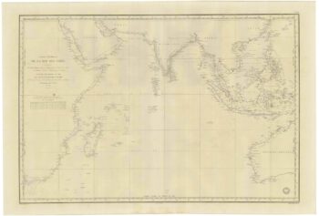
A French 19th century sea chart of the Indian Ocean
£550DAUSSY, Pierre.
Published In 1837
Stock No. 21222