Showing 1–12 of 77 results
-

An 18th century map of North America
£1,200WEIGEL, Christoph.
Published In 1718
Stock No. 24541 -

A mid-18th century map of North America
£850LOTTER, Tobias Conrad.
Published In 1765
Stock No. 24610 -

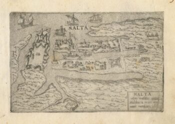
A 16th century town plan of Valletta
£200VALEGIO, Francesco.
Published In 1598
Stock No. 24173 -

A rare two volume geographical lexicon
£17,500LASOR A VAREA, Alphonsus.
Published In 1713
Stock No. 24516 -

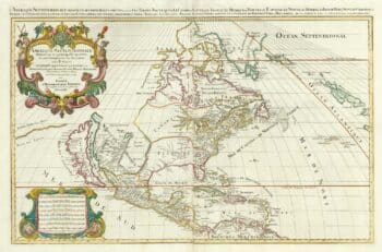
A two-sheet map of North America
£2,950JAILLOT, Alexis-Hubert.
Published In 1705
Stock No. 24062 -

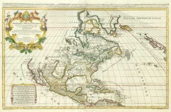
A two-sheet map of North America
£2,250JAILLOT, Alexis-Hubert.
Published In 1674
Stock No. 24482 -

Biography of Pope Pius V with a plate of Lepanto
£3,000CATENA, Girolamo.
Published In 1647
Stock No. 24340 -

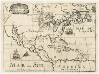
A rare Italian edition of Hennepin’s landmark map of Louisiana
£2,800HENNEPIN, Louis.
Published In 1691
Stock No. 24027 -

A 16th century Italian plan of Moscow
£450VALEGIO, Francesco.
Published In 1598
Stock No. 24142 -

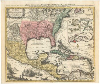
The European colonies in North America in the 18th century
£1,400SEUTTER, Matthaus.
Published In 1735
Stock No. 24089 -

A Dutch edition of rhe first printed map to accurately plot the Mississippi River
£1,700DELISLE, Guillaume.
Published In 1722
Stock No. 23463 -

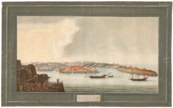
A rare 18th century view of Marsamxett
£3,750PULLICINO, Alberto.
Published In 1770
Stock No. 23426