Showing 1–12 of 510 results
-

A monumental 18th century wall map of Switzerland on four sheets
£6,500SCHEUCHZER, Johann Jakob.
Published In 1712
Stock No. 24499 -

The First Edition of Ortelius’s map of the Spice Islands
£4,000ORTELIUS, Abraham.
Published In 1570
Stock No. 24431 -

Victorian map of China with views of Hong Kong and Canton
£250TALLIS, John.
Published In 1851
Stock No. 23537 -

A late-18th century plan of Geneva
£250ANDREWS, John.
Published In 1800
Stock No. 24514 -

A late-18th century plan of Berlin
£260ANDREWS, John.
Published In 1800
Stock No. 24513 -

A pictorial map of Beijing in the 1930s
£3,000DORN, Frank.
Published In 1936
Stock No. 24392 -

The map of China from the first English atlas of the world
£3,700SPEED, John.
Published In 1665
Stock No. 23978 -

19th century Spanish sea chart of the Yellow Sea and Korea
£2,200BRYANT, Tomas.
Published In 1866
Stock No. 12450 -

A 19th century American sea chart of Hong Kong
£3,500BREWER, H.G.
Published In 1916
Stock No. 23973 -

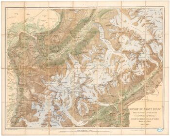
A detailed plan of the Mont-Blanc massif
£1,600BARBEY, Albert.
Published In 1924
Stock No. 22980 -

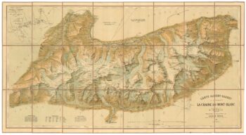
An important map of the Mont Blanc Massif
£950MIEULET, Jean-Joseph.
Published In 1865
Stock No. 24076 -

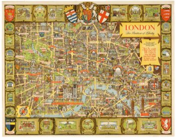
A post-war pictorial wall map of London
£1,400LEE, Kerry.
Published In 1955
Stock No. 23970