Showing 1–12 of 402 results
-

Zatta’s important map showing Cook’s charting of New Zealand
£1,750ZATTA, Antonio.
Published In 1778
Stock No. 24601 -

An early woodcut map of England
£1,000MUNSTER, Sebastian.
Published In 1572
Stock No. 24564 -

A late Victorian plan of Brighton.
£1,100TREACHER, H. & C.
Published In 1890
Stock No. 24546 -

A rare 18th century townplan of Worcester
£2,400YOUNG, George.
Published In 1780
Stock No. 24545 -

An 18th century map of North America
£1,200WEIGEL, Christoph.
Published In 1718
Stock No. 24541 -

16th century map of the Kingdom of Naples
£650ORTELIUS, Abraham.
Published In 1595
Stock No. 24444 -

A mid-18th century map of North America
£850LOTTER, Tobias Conrad.
Published In 1765
Stock No. 24610 -

The uncommon Spanish edition of Blaeu’s map of Hertfordshire
£450BLAEU, Johannes.
Published In 1662
Stock No. 24521 -

A 16th century town plan of Heraklion
£150VALEGIO, Francesco.
Published In 1598
Stock No. 24180 -

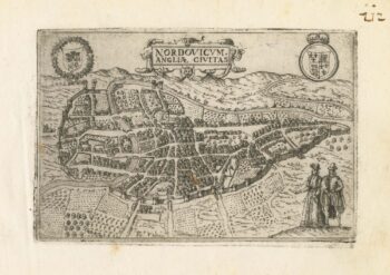
A 16th century town plan of Norwich
£300VALEGIO, Francesco.
Published In 1598
Stock No. 24135 -

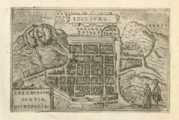
A 16th century town plan of Edinburgh
£380VALEGIO, Francesco.
Published In 1598
Stock No. 24133 -

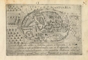
A 16th century Italian plan of Canterbury
£280VALEGIO, Francesco.
Published In 1598
Stock No. 24131