Showing 25–36 of 591 results
-

An extremely rare example of the first printed plan of Exeter
£4,500HOOKER, John.
Published In 1587
Stock No. 24437 -

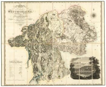
A large scale map of Westmorland in fine colour
£1,500GREENWOOD, C. & J.
Published In 1824
Stock No. 24069 -

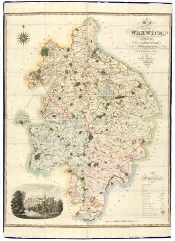
A large scale map of Warwickshire in fine colour
£1,600GREENWOOD, C. & J.
Published In 1822
Stock No. 24068 -

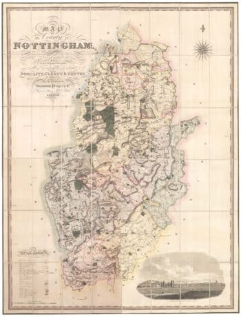
A large scale map of Nottinghamshire in fine colour
£2,000GREENWOOD, C. & J.
Published In 1826
Stock No. 24066 -

A large scale map of Leicestershire in fine colour
£2,200GREENWOOD, C. & J.
Published In 1826
Stock No. 24064 -

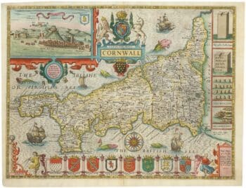
A rare issue of John Speed’s famous map of Cornwall
£1,600SPEED, John.
Published In 1665
Stock No. 24009 -

A rare issue of Speed’s map of Lancashire
£1,650SPEED, John.
Published In 1646
Stock No. 24002 -

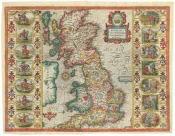
Speed’s famous map of the Saxon Heptarchy
£2,900SPEED, John.
Published In 1665
Stock No. 23788 -

A Victorian educational map of the British Isles
£1,700STARK, J.
Published In 1851
Stock No. 24080 -

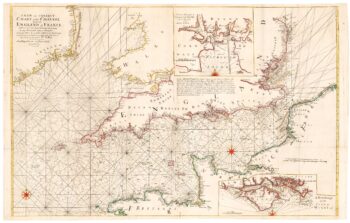
An 18th century two-sheet sea chart of the English Channel based on Halley
£1,250MOUNT & PAGE.
Published In 1745
Stock No. 23424 -

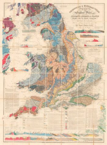
A detailed geological map of England and Wales
£1,500KNIPE, James Alexander.
Published In 1870
Stock No. 23418 -

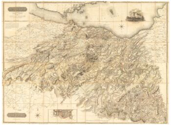
A large four-sheet map of Midlothian
£750KNOX, James.
Published In 1821
Stock No. 23326