Showing 337–348 of 365 results
-

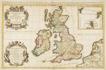
17th century map of the British Isles on two sheets
£1,200JAILLOT, Alexis-Hubert.
Published In 1696
Stock No. 14463 -

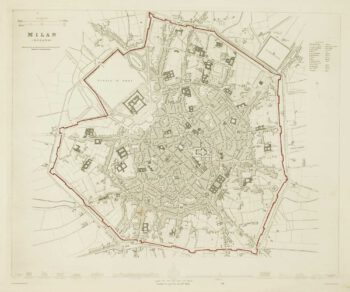
Detailed townplan of Milan
£130Society for the Diffusion of Useful Knowledge.
Published In 1862
Stock No. 14405 -

Map of the Cardiganshire, Montgomeryshire and Radnorshire from Drayton’s fantastical ‘Poly-Olbion’
£250DRAYTON, Michael.
Published In 1612
Stock No. 14049 -

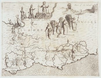
Map of Surrey and Sussex from Drayton’s fantastical ‘Poly-Olbion’
£450DRAYTON, Michael.
Published In 1612
Stock No. 14044 -

Map of Middlesex and Hertfordshire from Drayton’s fantastical ‘Poly-Olbion’
£400DRAYTON, Michael.
Published In 1612
Stock No. 14043 -

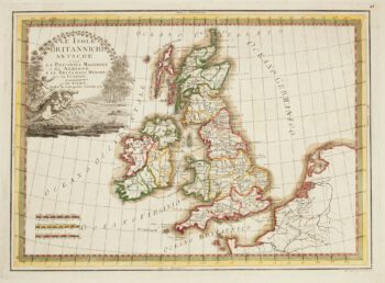
A map of the British Isles in ancient times
£300CASSINI, Giovanni Maria.
Published In 1799
Stock No. 13868 -

Detailed chart of the approaches to Harwich Harbour
£400BURN, George.
Published In 1794
Stock No. 13254 -
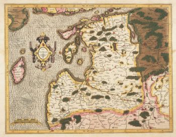
Mercator’s map of Latvia in fine original colour
£620MERCATOR, Gerard.
Published In 1595
Stock No. 13056 -

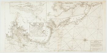
An important chart of the east coasts of England
£650MOUNT & PAGE.
Published In 1747
Stock No. 15582 -

Sea chart of the Firth of Forth from the first English sea-atlas
£480COLLINS, Greenvile.
Published In 1750
Stock No. 14900 -
Rare map of Middlesex, Essex and Herts
£1,100WARBURTON, John.
Published In 1726
Stock No. 12907 -

Road map from Stony Stratford to Derby
£250OGILBY, John.
Published In 1675
Stock No. 12372