Showing 1–12 of 76 results
-

Vrients’s scarce map of England, Wales & Ireland
£4,250VRIENTS, Jan Baptist.
Published In 1612
Stock No. 20271 -

A scarce two-sheet map of England and Wales with side panels
£3,000WILLDEY, George.
Published In 1715
Stock No. 24165 -

Speed’s famous map of the Saxon Heptarchy
£2,900SPEED, John.
Published In 1665
Stock No. 23788 -

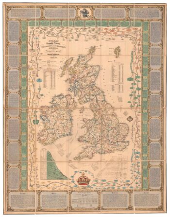
A Victorian educational map of the British Isles
£1,700STARK, J.
Published In 1851
Stock No. 24080 -

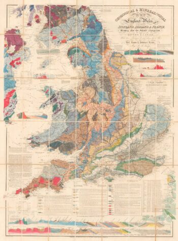
A detailed geological map of England and Wales
£1,500KNIPE, James Alexander.
Published In 1870
Stock No. 23418 -

A rare map of the British Isles with a prospect of the Great Fire of 1666
£12,000HOLLAR, Wenceslaus.
Published In 1667
Stock No. 24086 -

Speed’s map of the wars of England
£1,800SPEED, John.
Published In 1665
Stock No. 23791 -

The route of Saint Ursula and the 11,000 virgin martyrs
£800HOGENBERG, Abraham.
Published In 1647
Stock No. 23910 -

Early 18th century map of the British Isles
£220FER, Nicolas de.
Published In 1705
Stock No. 23765 -

A scarce, separate-issue map of the British Isles with decorative borders
£4,000VISSCHER, Claes Janszoon.
Published In 1650
Stock No. 23728 -

Miniature map of the East Midlands
£60PERROT, Aristide Michel.
Published In 1828
Stock No. 23304 -

England divided into the Saxon Heptarchy
£380SEUTTER, Matthaus.
Published In 1740
Stock No. 22311