Showing 241–252 of 283 results
-

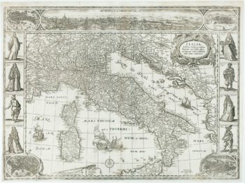
The first carte-à-figure map of Italy
£9,000BLAEU, Willem Janszoon.
Published In 1640
Stock No. 15244 -

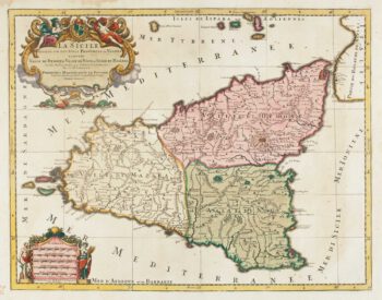
Early 18th century map of Sicily
£750JAILLOT, Alexis-Hubert.
Published In 1705
Stock No. 15024 -

A plan of Milan with vignettes of interiors
£400STUCCHI, Stanislao.
Published In 1853
Stock No. 15022 -

Zocchi’s dramatic views of mid-18th century Florence
£24,500ZOCCHI, Giuseppe.
Published In 1754
Stock No. 14735 -

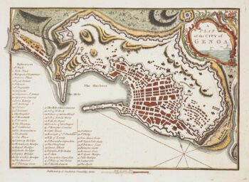
A late-18th century plan of Genoa during the Ligurian Republic
£130ANDREWS, John.
Published In 1800
Stock No. 14654 -

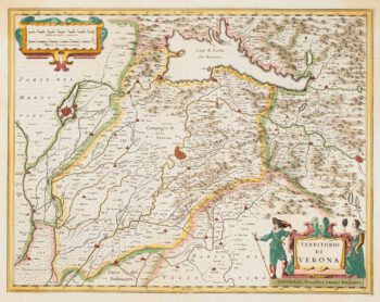
17th century map of the Province of Verona
£300JANSSON, Jan.
Published In 1636
Stock No. 14652 -

Two-sheet map of Sardinia in superb original colour
£880MORTIER, Pierre.
Published In 1705
Stock No. 14520 -

Mortier’s sea chart of Madagascar in full original colour
£1,100MORTIER, Pierre.
Published In 1700
Stock No. 14518 -

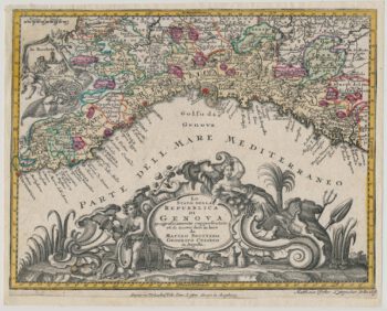
Decorative 18th century map of Liguria
£250SEUTTER, Matthaus.
Published In 1760
Stock No. 14512 -

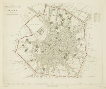
Detailed townplan of Milan
£130Society for the Diffusion of Useful Knowledge.
Published In 1862
Stock No. 14405 -

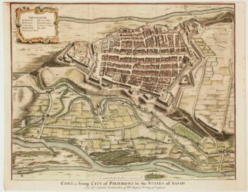
18th century plan of Cuneo
£240TINDAL & RAPIN.
Published In 1750
Stock No. 14332 -

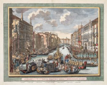
18th century view of the Venice Regatta
£600LOVISA, Domenico.
Published In 1717
Stock No. 14158