Showing 1–12 of 22 results
-

A 19th century American sea chart of Hong Kong
£3,500BREWER, H.G.
Published In 1916
Stock No. 23973 -

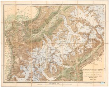
A detailed plan of the Mont-Blanc massif
£1,600BARBEY, Albert.
Published In 1924
Stock No. 22980 -

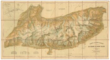
An important map of the Mont Blanc Massif
£950MIEULET, Jean-Joseph.
Published In 1865
Stock No. 24076 -

A detailed map of Victoria in the 1930s
£4,500WAR OFFICE.
Published In 1930
Stock No. 23458 -

A detailed Victorian map of Burma
£425ARROWSMITH, John.
Published In 1875
Stock No. 23852 -

The famous map of Leinster by John Speed
£750SPEED, John.
Published In 1665
Stock No. 23786 -

A scarce 17th century prospect of Saint-Jean-de-Maurienne in superb colour
£400BLAEU, Johannes.
Published In 1682
Stock No. 23269 -

Sea chart of south east Ireland with an inset of Dublin Bay
£550SELLER, Jeremiah.
Published In 1750
Stock No. 23160 -

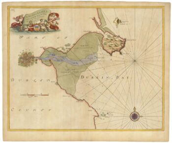
Sea chart of Dublin Bay from the first English sea-atlas
£550COLLINS, Greenvile.
Published In 1693
Stock No. 23156 -

Miniature map of Longford and West Meath
£100PERROT, Aristide Michel.
Published In 1828
Stock No. 23127 -

Miniature map of East Meath
£110PERROT, Aristide Michel.
Published In 1828
Stock No. 23126 -

Miniature map of Dublin
£110PERROT, Aristide Michel.
Published In 1828
Stock No. 23125