Showing 301–309 of 309 results
-

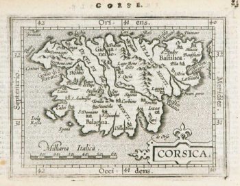
Miniature map of Corsica
£125ORTELIUS, Abraham.
Published In 1602
Stock No. 9121 -

The roads from Warrington to Chester and Manchester to Derby
£250OGILBY, John.
Published In 1675
Stock No. 9075 -

Plan of Toulon in the mid-19th century
£75Society for the Diffusion of Useful Knowledge.
Published In 1836
Stock No. 9047 -
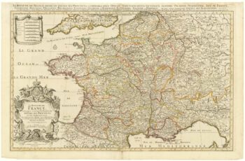
Map of France celebrating the military successes of Louis XIV
£450LOTTER, Tobias Conrad.
Published In 1750
Stock No. 8717 -

Blue-Back Chart of the Bay of Biscay
£650STEEL & CO.
Published In 1813
Stock No. 9661 -

French Post Roads
£280LOTTER, Tobias Conrad.
Published In 1750
Stock No. 8713 -

A two-sheet map of France
£700JAILLOT, Alexis-Hubert.
Published In 1705
Stock No. 8440 -

Guyenne
£240JANSSON, Jan.
Published In 1666
Stock No. 8391 -

An uncommon sea chart of France’s Mediterranean coast
£300LEVANTO, Francesco Maria.
Published In 1696
Stock No. 7408