Showing 1–12 of 58 results
-

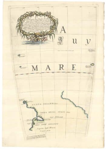
Zatta’s important map showing Cook’s charting of New Zealand
£1,750ZATTA, Antonio.
Published In 1778
Stock No. 24601 -

16th century map of the Kingdom of Naples
£650ORTELIUS, Abraham.
Published In 1595
Stock No. 24444 -

A 16th century town plan of Heraklion
£150VALEGIO, Francesco.
Published In 1598
Stock No. 24180 -

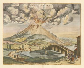
A rare lifetime printing of Blaeu’s view of Vesuvius erupting in 1631
£1,400BLAEU, Johannes.
Published In 1663
Stock No. 24506 -

A serio-comic map of Europe with the Russian octopus
£4,750GROSSI, Augusto.
Published In 1878
Stock No. 24393 -

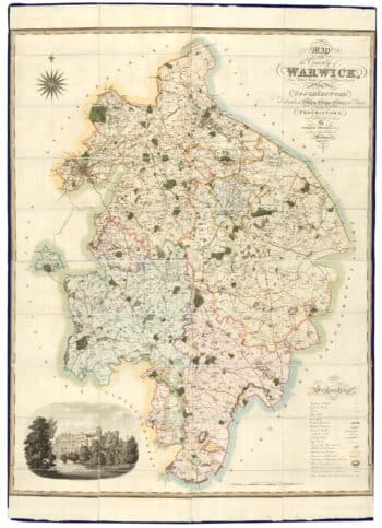
A large scale map of Warwickshire in fine colour
£1,600GREENWOOD, C. & J.
Published In 1822
Stock No. 24068 -

The New Zealand gore from Coronelli’s 42 inch globe
£2,200CORONELLI, Vincenzo Maria.
Published In 1693
Stock No. 23716 -

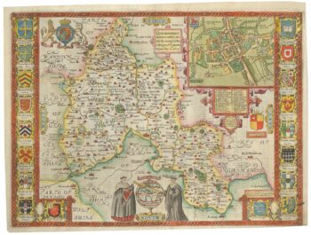
A scarce edition of John Speed’s map of Oxfordshire
£1,600SPEED, John.
Published In 1616
Stock No. 24019 -

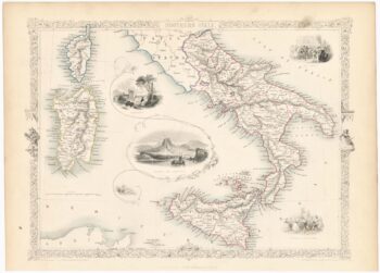
Mid-19th century map of southern Italy with vignettes
£125TALLIS, John.
Published In 1851
Stock No. 23547 -

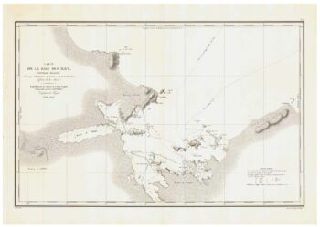
A detailed sea chart of the environs of Waitangi in New Zealand
£1,250DUPERREY, Louis-Isidore.
Published In 1829
Stock No. 23961 -

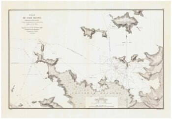
A detailed sea chart of the environs of Manawaora in New Zealand
£1,200DUPERREY, Louis-Isidore.
Published In 1829
Stock No. 23959 -

A French serio-comic map of Europe for the Great War
£1,850CRETE, B.
Published In 1915
Stock No. 23347