Showing 1–12 of 33 results
-

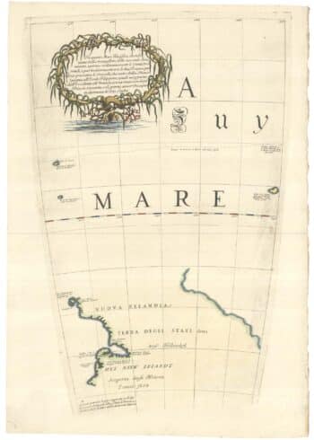
Zatta’s important map showing Cook’s charting of New Zealand
£1,750ZATTA, Antonio.
Published In 1778
Stock No. 24601 -

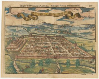
Early decorative birdseye view of Cusco
£380MUNSTER, Sebastian.
Published In 1572
Stock No. 24566 -

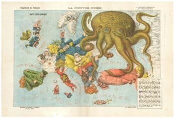
A serio-comic map of Europe with the Russian octopus
£4,750GROSSI, Augusto.
Published In 1878
Stock No. 24393 -

The New Zealand gore from Coronelli’s 42 inch globe
£2,200CORONELLI, Vincenzo Maria.
Published In 1693
Stock No. 23716 -

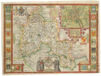
A scarce edition of John Speed’s map of Oxfordshire
£1,600SPEED, John.
Published In 1616
Stock No. 24019 -

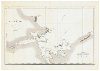
A detailed sea chart of the environs of Waitangi in New Zealand
£1,250DUPERREY, Louis-Isidore.
Published In 1829
Stock No. 23961 -

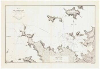
A detailed sea chart of the environs of Manawaora in New Zealand
£1,200DUPERREY, Louis-Isidore.
Published In 1829
Stock No. 23959 -

A French serio-comic map of Europe for the Great War
£1,850CRETE, B.
Published In 1915
Stock No. 23347 -

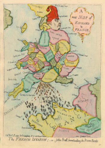
Caricature map of England in danger of invasion, from Gillray’s cruder output
£1,250GILLRAY, James.
Published In 1851
Stock No. 24158 -

A 16th century Italian plan of Cusco
£380VALEGIO, Francesco.
Published In 1598
Stock No. 24137 -

Map of the city and university of Oxford
£240MOULE, Thomas.
Published In 1848
Stock No. 23657 -

A map of Oxford in Elizabethan times
£1,250AGAS, Ralph.
Published In 1733
Stock No. 23589