Showing all 12 results
-

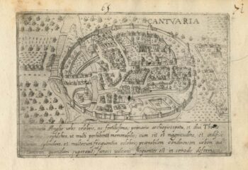
A 16th century Italian plan of Canterbury
£280VALEGIO, Francesco.
Published In 1598
Stock No. 24131 -

Friuli from the first English Edition of the ‘Atlas Minor’
£240HONDIUS, Jodocus.
Published In 1635
Stock No. 22396 -

A 17th century townplan of Dover
£120HERMANNIDES, Rutger.
Published In 1661
Stock No. 22789 -

Early bird’s-eye map-view of Canterbury
£900BRAUN, Georg & HOGENBERG, Frans.
Published In 1588
Stock No. 22168 -

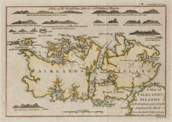
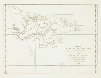
18th century map of the Falkland Islands
£100LODGE, John.
Published In 1770
Stock No. 22014 -

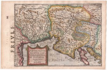
A 16th century miniature map of Friuli
£150LANGENES, Barent.
Published In 1599
Stock No. 21354 -

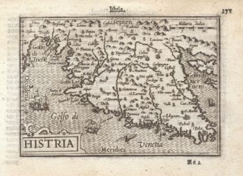
A 16th century miniature map of Istria
£130LANGENES, Barent.
Published In 1599
Stock No. 21352 -

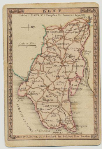
A scarce playing-card map of Kent
£500ALLEN, Joseph.
Published In 1811
Stock No. 18725 -

Map of Chile and Argentina with vignettes
£120TALLIS, John.
Published In 1851
Stock No. 18805 -

Early chart of the Falkland Islands
£130NOUAL, Isaac.
Published In 1773
Stock No. 17278 -
Urban planning in Erith during the Age of the Railway
£600Anonymous.
Published In 1873
Stock No. 16089 -

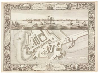
Fine plan of the naval dockyard at Sheerness, Kent
£600MILTON, Thomas.
Published In 1755
Stock No. 8492