Showing 1–12 of 40 results
-

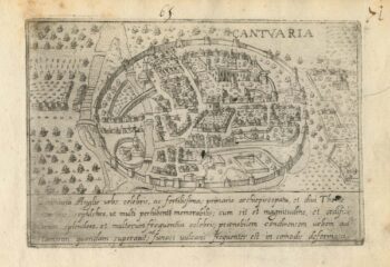
A 16th century Italian plan of Canterbury
£280VALEGIO, Francesco.
Published In 1598
Stock No. 24131 -

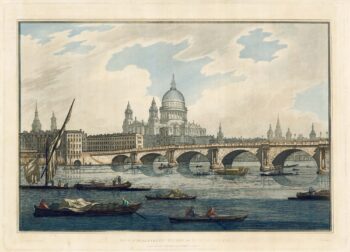
18th century view of the City from the Thames
£1,500FARINGTON, Joseph.
Published In 1790
Stock No. 24557 -

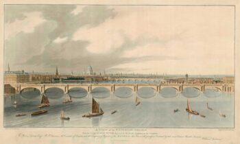
A prospect of the new Waterloo Bridge
£2,200ANDERSON, William.
Published In 1822
Stock No. 18488 -

Prospect of medieval London Bridge covered with houses
£2,400NICHOLLS, Sutton.
Published In 1705
Stock No. 23438 -

The scarce second state of the Lhuyd-Hondius map of Wales
£550LHUYD, Humfrey.
Published In 1638
Stock No. 23841 -

The first British atlas map of Wales
£1,700SPEED, John.
Published In 1665
Stock No. 23789 -

Miniature map of Cardiganshire, Randorshire and Brecknockshire
£75PERROT, Aristide Michel.
Published In 1828
Stock No. 23106 -

Miniature map of Merionethshire and Montgomeryshire
£150PERROT, Aristide Michel.
Published In 1828
Stock No. 23105 -
Miniature map of map of Anglesey
£150PERROT, Aristide Michel.
Published In 1828
Stock No. 23073 -

Blaeu’s map of Pembrokeshire and Carmarthenshire, with fine colour
£500BLAEU, Johannes.
Published In 1662
Stock No. 23042 -

A 17th century townplan of Newport
£160HERMANNIDES, Rutger.
Published In 1661
Stock No. 22781 -

Lhuyd’s map of Wales, as published in a historical atlas
£650LHUYD, Humfrey.
Published In 1700
Stock No. 22741