Showing 1–12 of 127 results
-

Zatta’s important map showing Cook’s charting of New Zealand
£1,750ZATTA, Antonio.
Published In 1778
Stock No. 24601 -

Map of Australia and New Zealand after Cook’s First Voyage to the Pacific
£1,000ZATTA, Antonio.
Published In 1776
Stock No. 24599 -

John Oxley’s mapping of New South Wales
£280HALL, Sidney.
Published In 1828
Stock No. 24519 -

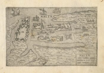
A 16th century town plan of Valletta
£200VALEGIO, Francesco.
Published In 1598
Stock No. 24173 -

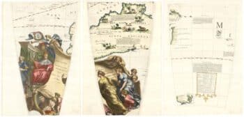
Set of three gores covering Australia from Coronelli’s 42 inch globe
£4,500CORONELLI, Vincenzo Maria.
Published In 1693
Stock No. 23726 -

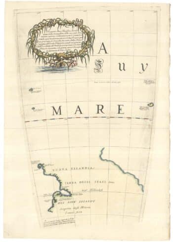
The New Zealand gore from Coronelli’s 42 inch globe
£2,200CORONELLI, Vincenzo Maria.
Published In 1693
Stock No. 23716 -

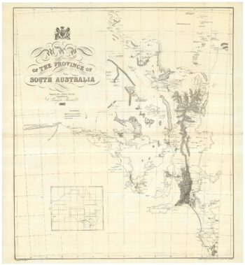
A detailed 19th century survey of South Australia
£950HARRIS, W.G.
Published In 1862
Stock No. 24105 -

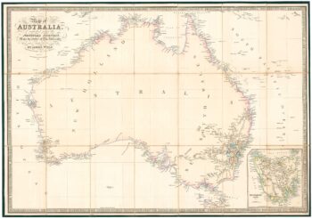
Folding map of Australia with fine colour
£980WYLD, James.
Published In 1833
Stock No. 24071 -

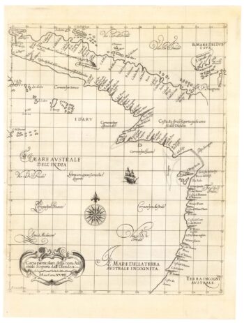
The first map of Australia by an Englishman
£8,500DUDLEY, Robert.
Published In 1646
Stock No. 23777 -

An unusual Italian map of Australia
£650MARMOCCHI, Francesco C.
Published In 1858
Stock No. 23588 -

A mid-19th century map of Victoria marking the gold fields
£150TALLIS, John.
Published In 1851
Stock No. 23543 -

A mid-19th century map of Polynesia with decorative vignettes
£110TALLIS, John.
Published In 1851
Stock No. 21597