Showing 1–12 of 335 results
-

A late Victorian plan of Brighton.
£1,100TREACHER, H. & C.
Published In 1890
Stock No. 24546 -

A rare 18th century townplan of Worcester
£2,400YOUNG, George.
Published In 1780
Stock No. 24545 -

A map illustrating the British dominance of the seas
£450LONDON GEOGRAPHICAL INSTITUTE.
Published In 1922
Stock No. 24508 -

The Peutinger Table, one of the few surviving examples of Roman cartography
£2,000JANSSON, Jan.
Published In 1700
Stock No. 24492 -

A miniature double-hemisphere world.
£600SANSON, Nicolas.
Published In 1735
Stock No. 22316 -

The uncommon Spanish edition of Blaeu’s map of Hertfordshire
£450BLAEU, Johannes.
Published In 1662
Stock No. 24521 -

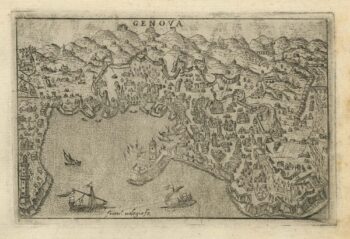
A 16th century town plan of Genova
£250VALEGIO, Francesco.
Published In 1598
Stock No. 24198 -

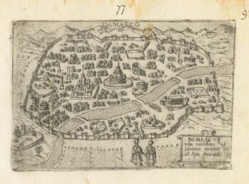
A 16th century Italian plan of Damascus
£300VALEGIO, Francesco.
Published In 1598
Stock No. 24152 -

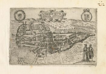
A 16th century town plan of Norwich
£300VALEGIO, Francesco.
Published In 1598
Stock No. 24135 -

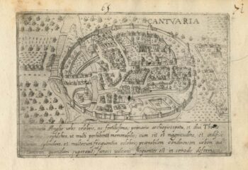
A 16th century Italian plan of Canterbury
£280VALEGIO, Francesco.
Published In 1598
Stock No. 24131 -

A serio-comic map satirising Ronald Reagan’s view of the World
£650HORSEY, David.
Published In 1984
Stock No. 24474 -

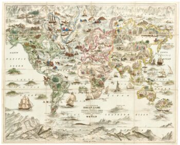
A Victorian game map of the world.
£5,500JONES, Thomas Henry.
Published In 1845
Stock No. 24423