Showing 1–12 of 43 results
-

A large scale map of Westmorland in fine colour
£1,500GREENWOOD, C. & J.
Published In 1824
Stock No. 24069 -

Decorative 18th century map of Norway
£460HOMANN, Johann Baptist.
Published In 1720
Stock No. 24171 -

An 18th century map of the Virgin Islands
£700EDWARDS, Bryan.
Published In 1794
Stock No. 24169 -

A rare issue of Speed’s map of Westmorland
£550SPEED, John.
Published In 1665
Stock No. 24006 -

Late 18th century map of Florida & Georgia
£550TARDIEU, Pierre Fran?ois.
Published In 1795
Stock No. 23906 -

An 18th century map of the West Indies
£290JEFFERYS, Thomas.
Published In 1768
Stock No. 23673 -
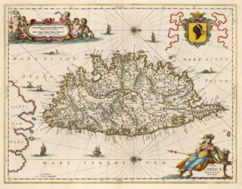
A decorative 17th century map of Corsica
£1,100JANSSON, Jan.
Published In 1650
Stock No. 23619 -

Ortelius’s antique map of the West Indies and Culiac?n in Mexico
£1,250ORTELIUS, Abraham.
Published In 1584
Stock No. 23599 -

The Muscovy Company whaling at Svalbard
£950EDGE, Thomas.
Published In 1625
Stock No. 23464 -

17th century old maps of the West Indian Islands
£1,200HONDIUS, Jodocus.
Published In 1623
Stock No. 23456 -

The English possessions in the West Indies
£850SENEX, John.
Published In 1721
Stock No. 23423 -

One of the few early map focusing on Norway
£850DE WIT, Frederick.
Published In 1680
Stock No. 23247