Showing 1–12 of 21 results
-

Munster’s map of northern Europe after Ortelius
£750MUNSTER, Sebastian.
Published In 1514
Stock No. 24585 -

A 16th century town plan of Tangier
£220VALEGIO, Francesco.
Published In 1598
Stock No. 24217 -

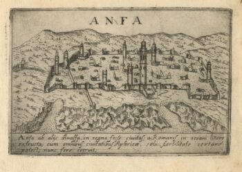
A 16th century town plan of Casablanca
£240VALEGIO, Francesco.
Published In 1598
Stock No. 24215 -

A 16th century town plan of Heraklion
£150VALEGIO, Francesco.
Published In 1598
Stock No. 24180 -

A 16th century map of Morocco
£700ORTELIUS, Abraham.
Published In 1601
Stock No. 23718 -

One of the most detailed maps of the Gal?pagos before Darwin
£700VANDERMAELEN, Philippe.
Published In 1827
Stock No. 23920 -

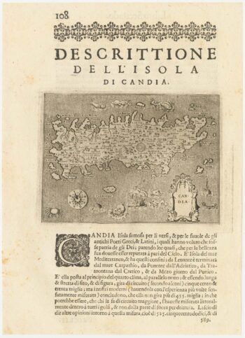
A 16th century map of Crete
£180PORCACCHI, Tomaso.
Published In 1590
Stock No. 23214 -

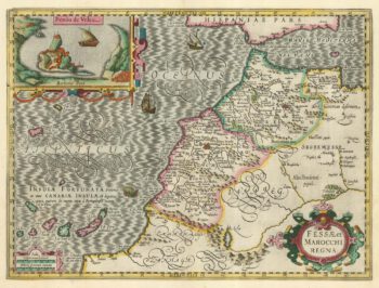
A 17th century map of Morocco in fine original colour
£650HONDIUS, Jodocus.
Published In 1630
Stock No. 22653 -

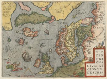
The famous Ortelius map of the northern Atlantic regions
£2,250ORTELIUS, Abraham.
Published In 1612
Stock No. 22499 -

A detailed map of Dominica during the American War of Independence
£850BUACHE, Philippe.
Published In 1778
Stock No. 22487 -

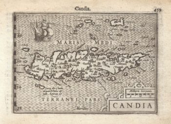
A 16th century miniature map of Crete
£240LANGENES, Barent.
Published In 1599
Stock No. 21328 -

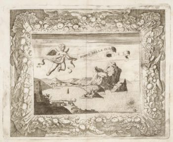
A rare view of Souda, with decorative borders
£460LOCATELLI, Alessandro.
Published In 1691
Stock No. 21035