Showing 1–12 of 50 results
-

18th century map of the Eastern Seaboard
£750ROBERT DE VAUGONDY, Didier.
Published In 1770
Stock No. 24555 -

Vancouver’s mapping of the Pacific North West
£350VANCOUVER, Capt. George.
Published In 1820
Stock No. 24534 -

A 16th century town plan of Heraklion
£150VALEGIO, Francesco.
Published In 1598
Stock No. 24180 -

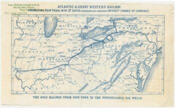
An advert for an American railway
£750Anonymous.
Published In 1865
Stock No. 24455 -

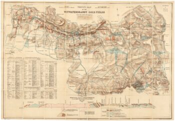
A scarce map of the gold rush near Johannesburg
£1,900TROYE, Gustav Arthur.
Published In 1892
Stock No. 24104 -

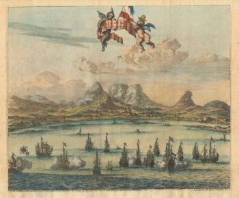
Cape of Good Hope naval prospect
£400AA, Pieter van der.
Published In 1719
Stock No. 24077 -

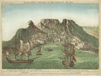
18th century vue d’optique of the Cape of Good Hope
£600RIEDEL, Gottlieb Friedrich.
Published In 1780
Stock No. 23736 -

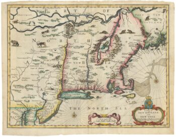
The Speed map of New England
£6,500SPEED, John.
Published In 1676
Stock No. 23794 -

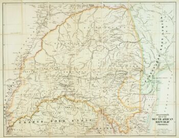
Contemporary map of Transvaal on the cusp of the Second Boer War
£350STANFORD, Edward.
Published In 1899
Stock No. 22677 -

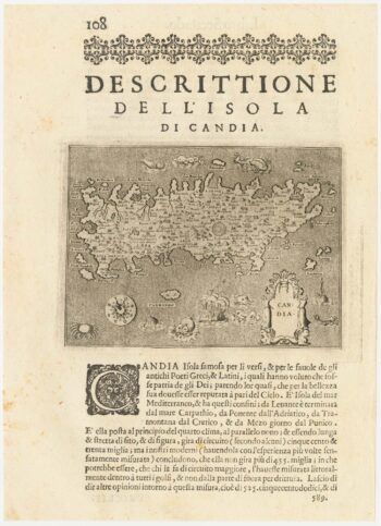
A 16th century map of Crete
£180PORCACCHI, Tomaso.
Published In 1590
Stock No. 23214 -

Map of Cape Colony with vignettes
£150TALLIS, John.
Published In 1851
Stock No. 18542 -

A contemporary military folding map for the Anglo-Zulu War of 1879.
£650WYLD, James.
Published In 1879
Stock No. 22989