Showing 1–12 of 80 results
-

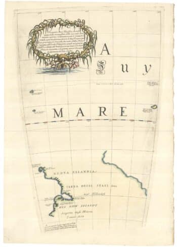
Zatta’s important map showing Cook’s charting of New Zealand
£1,750ZATTA, Antonio.
Published In 1778
Stock No. 24601 -

The First Edition of Ortelius’s map of the Spice Islands
£4,000ORTELIUS, Abraham.
Published In 1570
Stock No. 24431 -

An extremely rare example of the first printed plan of Exeter
£4,500HOOKER, John.
Published In 1587
Stock No. 24437 -

The New Zealand gore from Coronelli’s 42 inch globe
£2,200CORONELLI, Vincenzo Maria.
Published In 1693
Stock No. 23716 -

Early 18th century map of the East Indies
£980DELISLE, Guillaume.
Published In 1705
Stock No. 23907 -
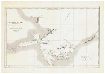
A detailed sea chart of the environs of Waitangi in New Zealand
£1,250DUPERREY, Louis-Isidore.
Published In 1829
Stock No. 23961 -

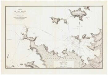
A detailed sea chart of the environs of Manawaora in New Zealand
£1,200DUPERREY, Louis-Isidore.
Published In 1829
Stock No. 23959 -

Miniature map of Devon
£80PERROT, Aristide Michel.
Published In 1828
Stock No. 23303 -

Rare map of the interests of the V.O.C. in the East Indies
£1,650RENNEVILLE, Ren? Auguste Constantin.
Published In 1725
Stock No. 22933 -

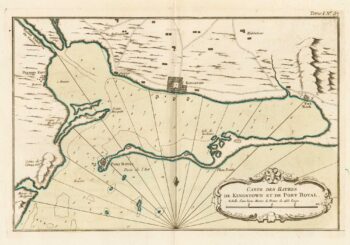
Map of Kingston in Jamaica
£175BELLIN, Jacques-Nicolas.
Published In 1764
Stock No. 23713 -

A scarce issue of John Speed’s map of Devon
£1,100SPEED, John.
Published In 1611
Stock No. 24038 -

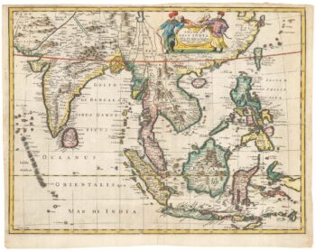
17th century English map of the East Indies
£2,200SPEED, John.
Published In 1676
Stock No. 23799