Showing 1–12 of 13 results
-

Blaeu’s classic 17th century map of Iceland
£1,200BLAEU, Willem Janszoon.
Published In 1635
Stock No. 24604 -

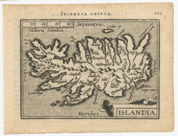
An early 17th century map of Iceland
£350HONDIUS, Jodocus.
Published In 1610
Stock No. 24509 -

An extremely rare example of the first printed plan of Exeter
£4,500HOOKER, John.
Published In 1587
Stock No. 24437 -

Miniature map of Devon
£80PERROT, Aristide Michel.
Published In 1828
Stock No. 23303 -
Rare map of Iceland
£525SAUZET, Henri de.
Published In 1734
Stock No. 23691 -

A scarce issue of John Speed’s map of Devon
£1,100SPEED, John.
Published In 1611
Stock No. 24038 -

An uncommon Italian map of Iceland
£420CASSINI, Giovanni Maria.
Published In 1794
Stock No. 23742 -

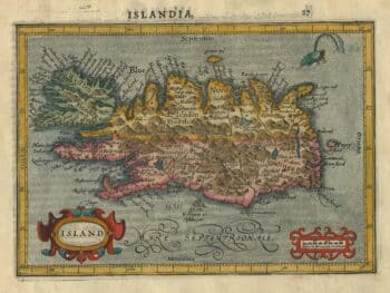
Early 17th century map of Iceland in fabulous early colour
£1,800MERCATOR, Gerard.
Published In 1608
Stock No. 23475 -

The famous sea-monsters map of Iceland
£13,500ORTELIUS, Abraham.
Published In 1595
Stock No. 23343 -

The scarce second Galle plate for Iceland used in the ‘Epitome’
£600ORTELIUS, Abraham.
Published In 1598
Stock No. 23194 -

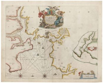
Sea chart of Plymouth from the first English sea-atlas
£450COLLINS, Greenvile.
Published In 1693
Stock No. 21702 -
A detailed Victorian plan of Plymouth
£120TALLIS, John.
Published In 1851
Stock No. 17732