Showing 1–12 of 31 results
-

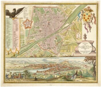
An 18th century city map and prospect of Florence
£1,350HOMANN HEIRS.
Published In 1731
Stock No. 24446 -

An extremely rare example of the first printed plan of Exeter
£4,500HOOKER, John.
Published In 1587
Stock No. 24437 -

A caricature of Churchill as an octopus, produced for occupied France
£1,000S.P.K.
Published In 1942
Stock No. 24106 -

A 16th century town plan of Florence
£300VALEGIO, Francesco.
Published In 1598
Stock No. 24193 -

Miniature map of Devon
£80PERROT, Aristide Michel.
Published In 1828
Stock No. 23303 -

A 16th century town plan of Siena
£400VALEGIO, Francesco.
Published In 1598
Stock No. 24194 -

A scarce issue of John Speed’s map of Devon
£1,100SPEED, John.
Published In 1611
Stock No. 24038 -

The story of the Spanish Armada from the House of Lords tapestries
£950PINE, John.
Published In 1739
Stock No. 23245 -

17th century bird’s-eye view of Siena
£480MERIAN, Matthaus.
Published In 1640
Stock No. 22473 -

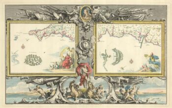
A pair of 17th century engravings of the Battle of Cannae, 216BC
£300RALEIGH, Walter.
Published In 1620
Stock No. 22236 -

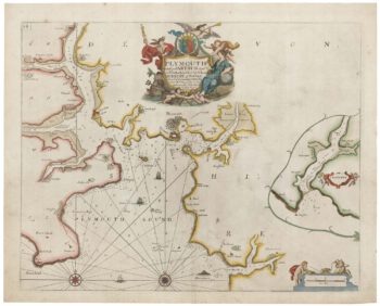
Sea chart of Plymouth from the first English sea-atlas
£450COLLINS, Greenvile.
Published In 1693
Stock No. 21702 -

16th century woodcut map of the Tuscan Archipelago
£450ALBERTI, Leandro.
Published In 1588
Stock No. 21496