Showing 61–72 of 116 results
-

A sketch map of Cap d’Agde and Fort de Brescou
£180CORONELLI, Vincenzo Maria.
Published In 1688
Stock No. 21226 -

A decorative sea chart of the environs of Brest
£550CORONELLI, Vincenzo Maria.
Published In 1689
Stock No. 21213 -

A detailed 18th century map of Brittany
£420HOMANN, Johann Baptist.
Published In 1720
Stock No. 21195 -

17th century map of Oleron
£240CORONELLI, Vincenzo Maria.
Published In 1690
Stock No. 21090 -

Paris and surrounding areas in the mid 19th century
£900CHARLE, Jean Baptiste Louis.
Published In 1841
Stock No. 20904 -

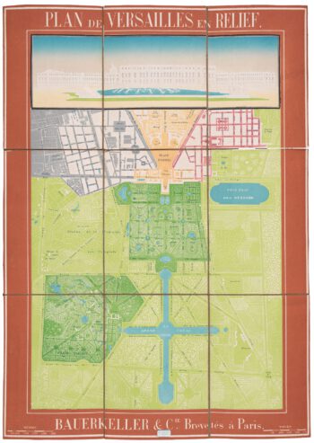
A scarce relief plan of the gardens of Versailles
£800BAUERKELLER et C.ie.
Published In 1860
Stock No. 20635 -

A map of Saint Marguerite with Cannes and Antibes
£280CORONELLI, Vincenzo Maria.
Published In 1690
Stock No. 20625 -

A large plan of Paris during the Rise of Napoleon
£1,000ROBERT DE VAUGONDY, Didier.
Published In 1797
Stock No. 20620 -

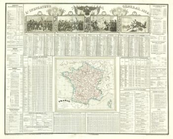
A French almanac for 1834 with vignettes of Napoleon Bonaparte
£220Anonymous.
Published In 1834
Stock No. 20604 -

A detailed 18th century map of Corsica after Jaillot
£650SANTINI, Francesco & SANTINI, Paolo.
Published In 1784
Stock No. 21914 -

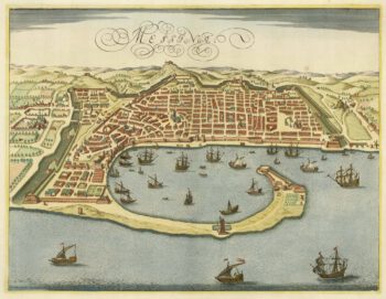
An uncommon state of Jansson’s plan of Messina
£900JANSSON, Jan.
Published In 1694
Stock No. 21911 -

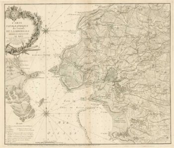
18th century separate-issue plan of La Rochelle
£700BEAURAIN, Jean de.
Published In 1758
Stock No. 19576