Showing 1–12 of 31 results
-

18th century map of the Eastern Seaboard
£750ROBERT DE VAUGONDY, Didier.
Published In 1770
Stock No. 24555 -

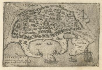
A 16th century Italian plan of Alexandria
£240VALEGIO, Francesco.
Published In 1598
Stock No. 24149 -

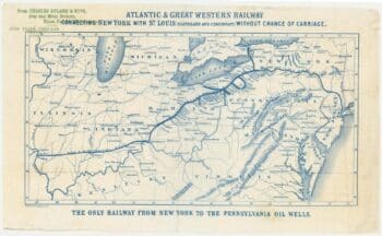
An advert for an American railway
£750Anonymous.
Published In 1865
Stock No. 24455 -

A map of the early Church in Egypt and Lybia
£650SANSON, Nicolas.
Published In 1704
Stock No. 24115 -

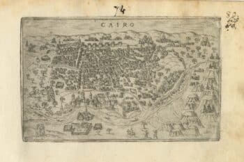
A 16th century Italian plan of Cairo
£250VALEGIO, Francesco.
Published In 1598
Stock No. 24146 -

A ‘bird’s-eye’ map of the Gordon Relief Mission, 1884
£1,750BACON, George Washington.
Published In 1885
Stock No. 24107 -

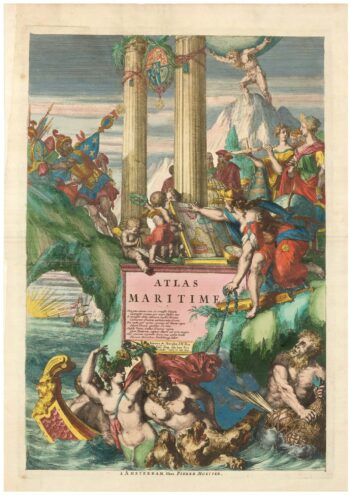
The title page to a sea atlas in superb colour
£1,200HOOGHE, Romeyn de.
Published In 1693
Stock No. 24410 -

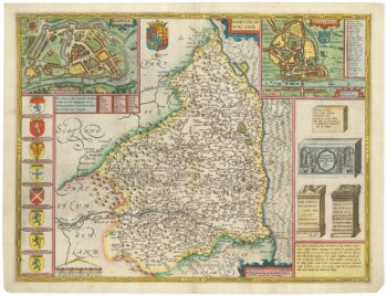
A scarce issue of John Speed’s map of Northumberland
£600SPEED, John.
Published In 1665
Stock No. 24023 -

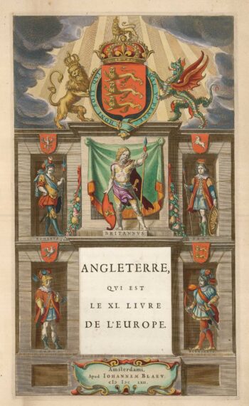
The titlepage of the England volume of ‘Le Grand Atlas’
£300BLAEU, Johannes.
Published In 1662
Stock No. 24082 -

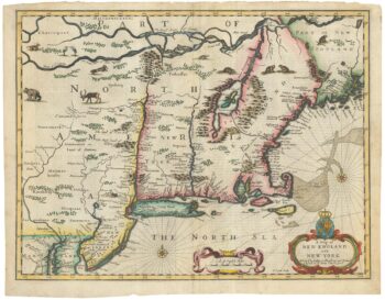
The Speed map of New England
£6,500SPEED, John.
Published In 1676
Stock No. 23794 -

Decorative map of Egypt and the Nile
£450HOMANN, Johann Baptist.
Published In 1725
Stock No. 23263 -

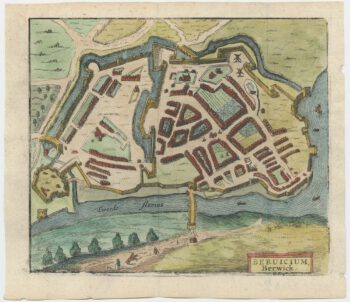
A 17th century townplan of Berwick
£150HERMANNIDES, Rutger.
Published In 1661
Stock No. 22802