Showing 1–12 of 270 results
-

Vrients’s scarce map of England, Wales & Ireland
£4,250VRIENTS, Jan Baptist.
Published In 1612
Stock No. 20271 -

A monumental 18th century wall map of Switzerland on four sheets
£6,500SCHEUCHZER, Johann Jakob.
Published In 1712
Stock No. 24499 -

A 16th century map of the colony of New Spain
£750ORTELIUS, Abraham.
Published In 1584
Stock No. 24448 -

A late-18th century plan of Geneva
£250ANDREWS, John.
Published In 1800
Stock No. 24514 -

A late-18th century plan of Berlin
£260ANDREWS, John.
Published In 1800
Stock No. 24513 -

A scarce two-sheet map of England and Wales with side panels
£3,000WILLDEY, George.
Published In 1715
Stock No. 24165 -

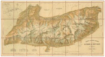
A detailed plan of the Mont-Blanc massif
£1,600BARBEY, Albert.
Published In 1924
Stock No. 22980 -

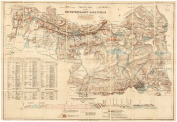
A scarce map of the gold rush near Johannesburg
£1,900TROYE, Gustav Arthur.
Published In 1892
Stock No. 24104 -

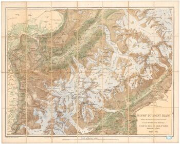
An important map of the Mont Blanc Massif
£950MIEULET, Jean-Joseph.
Published In 1865
Stock No. 24076 -

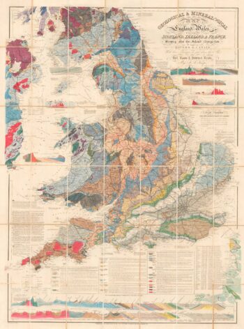
A detailed geological map of England and Wales
£1,500KNIPE, James Alexander.
Published In 1870
Stock No. 23418 -
An impressive 16th century two-sheet plan of Antwerp
£1,500HOEFNAGEL, Joris.
Published In 1596
Stock No. 23372 -

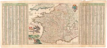
A 17th century map of France with rare gazzetteer side-panels
£750VISSCHER, Nicolas.
Published In 1690
Stock No. 23744