Showing 1–12 of 105 results
-

The Peutinger Table, one of the few surviving examples of Roman cartography
£2,000JANSSON, Jan.
Published In 1700
Stock No. 24492 -

A 16th century woodcut map of Greece
£380MUNSTER, Sebastian.
Published In 1572
Stock No. 24576 -

A 16th century town plan of Rhodes
£250ROTA, Martin.
Published In 1598
Stock No. 24199 -

A 16th century town plan of Corfu City
£250VALEGIO, Francesco.
Published In 1598
Stock No. 24181 -

A 16th century town plan of Heraklion
£150VALEGIO, Francesco.
Published In 1598
Stock No. 24180 -

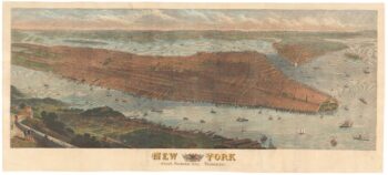
A highly-detailed prospect of Manhattan
£3,500SULMAN, Thomas.
Published In 1876
Stock No. 23720 -

One of the earliest versions of Sophianos’s map of Greece
£14,000BERTELLI, Ferrando
Published In 1564
Stock No. 24220 -

Miniature map of Donegal
£85PERROT, Aristide Michel.
Published In 1828
Stock No. 23300 -

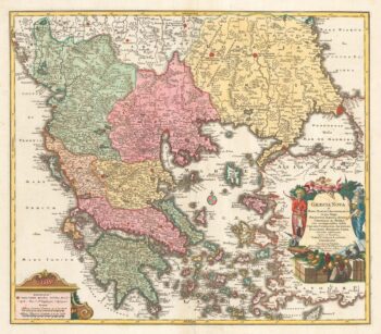
A decorative 18th century map of Greece
£500SEUTTER, Matthaus.
Published In 1750
Stock No. 22308 -

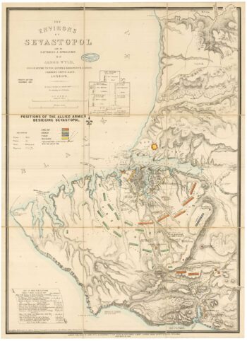
A contemporary map of the Siege of Sevastopol
£350WYLD, James.
Published In 1854
Stock No. 24100 -

A contemporary map of the Siege of Sevastopol
£350WYLD, James.
Published In 1854
Stock No. 24099 -

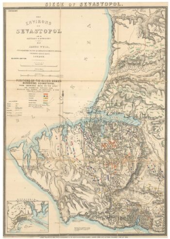
A contemporary map of the Siege of Sevastopol
£350WYLD, James.
Published In 1855
Stock No. 24098