Showing 1–12 of 96 results
-

A 16th century woodcut map of Greece
£380MUNSTER, Sebastian.
Published In 1572
Stock No. 24576 -

A 16th century town plan of Rhodes
£250ROTA, Martin.
Published In 1598
Stock No. 24199 -

A 16th century town plan of Corfu City
£250VALEGIO, Francesco.
Published In 1598
Stock No. 24181 -

A 16th century town plan of Heraklion
£150VALEGIO, Francesco.
Published In 1598
Stock No. 24180 -

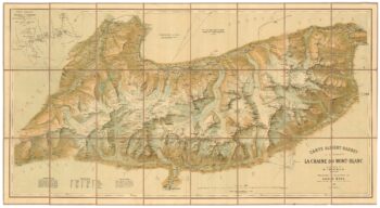
A detailed plan of the Mont-Blanc massif
£1,600BARBEY, Albert.
Published In 1924
Stock No. 22980 -

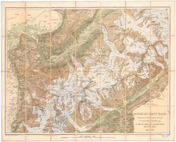
An important map of the Mont Blanc Massif
£950MIEULET, Jean-Joseph.
Published In 1865
Stock No. 24076 -

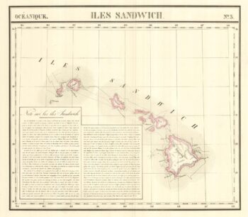
The largest representation of Hawaii to appear in an atlas
£900VANDERMAELEN, Philippe.
Published In 1827
Stock No. 24396 -

One of the earliest versions of Sophianos’s map of Greece
£14,000BERTELLI, Ferrando
Published In 1564
Stock No. 24220 -

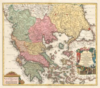
A decorative 18th century map of Greece
£500SEUTTER, Matthaus.
Published In 1750
Stock No. 22308 -

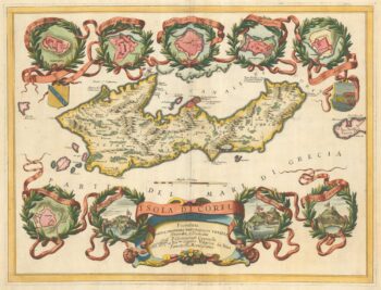
A large and decorative map of Corfu
£750CORONELLI, Vincenzo Maria.
Published In 1690
Stock No. 24095 -

Rare town-plan of Corfu under siege by the Ottomans
£340WIERING, Thomas von.
Published In 1716
Stock No. 23665 -

An 18th century chart of Corfu
£110ROUX, Joseph.
Published In 1804
Stock No. 23636