Showing 1–12 of 43 results
-

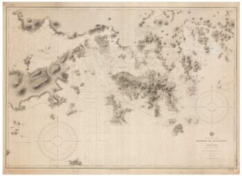
A 19th century American sea chart of Hong Kong
£3,500BREWER, H.G.
Published In 1916
Stock No. 23973 -

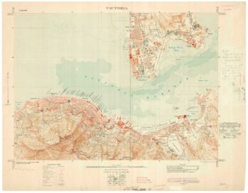
A detailed map of Victoria in the 1930s
£4,500WAR OFFICE.
Published In 1930
Stock No. 23458 -

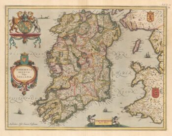
Sir William Petty’s mapping of Ireland
£1,500LEA, Philip.
Published In 1689
Stock No. 24379 -

A scarce issue of John Speed’s map of Rutland
£600SPEED, John.
Published In 1665
Stock No. 24025 -

An early issue of Jansson’s map of Ireland
£950JANSSON, Jan.
Published In 1638
Stock No. 23865 -

An uncommon state of Mercator’s pair of maps of Ireland
£1,250MERCATOR, Gerard.
Published In 1638
Stock No. 23864 -

Miniature map of Donegal
£85PERROT, Aristide Michel.
Published In 1828
Stock No. 23300 -

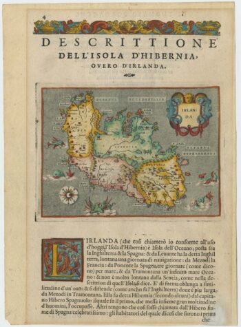
A 16th century map of Ireland with sea-monsters
£300PORCACCHI, Tomaso.
Published In 1576
Stock No. 24013 -

The famous map of Leinster by John Speed
£750SPEED, John.
Published In 1665
Stock No. 23786 -

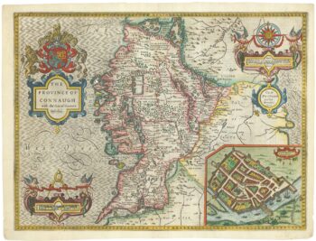
A 17th century map of Connaught
£800SPEED, John.
Published In 1665
Stock No. 23784 -
The Indian Ocean from Ortelius’s ”Parergon”
£950ORTELIUS, Abraham.
Published In 1608
Stock No. 23719 -

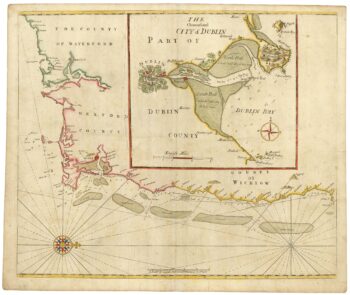
Sea chart of south east Ireland with an inset of Dublin Bay
£550SELLER, Jeremiah.
Published In 1750
Stock No. 23160