Showing 1–12 of 47 results
-

A two-sheet map of North America
£2,950JAILLOT, Alexis-Hubert.
Published In 1705
Stock No. 24062 -

A two-sheet map of North America
£2,250JAILLOT, Alexis-Hubert.
Published In 1674
Stock No. 24482 -

A rare Italian edition of Hennepin’s landmark map of Louisiana
£2,800HENNEPIN, Louis.
Published In 1691
Stock No. 24027 -

The European colonies in North America in the 18th century
£1,400SEUTTER, Matthaus.
Published In 1735
Stock No. 24089 -

Scarce town plan of Singapore in the 1950s
£1,200FEDERATION OF MALAYA SURVEY DEPT.
Published In 1953
Stock No. 23955 -

A detailed Victorian map of Burma
£425ARROWSMITH, John.
Published In 1875
Stock No. 23852 -

The famous map of Leinster by John Speed
£750SPEED, John.
Published In 1665
Stock No. 23786 -

The first European map of Singapore
£6,500DE BRY, Theodore.
Published In 1603
Stock No. 23471 -

A Dutch edition of rhe first printed map to accurately plot the Mississippi River
£1,700DELISLE, Guillaume.
Published In 1722
Stock No. 23463 -

18th century map of Indochina
£450TIRION, Isaak.
Published In 1734
Stock No. 23412 -

Sea chart of south east Ireland with an inset of Dublin Bay
£550SELLER, Jeremiah.
Published In 1750
Stock No. 23160 -

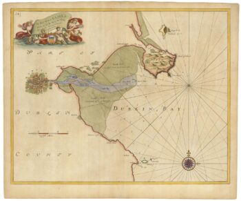
Sea chart of Dublin Bay from the first English sea-atlas
£550COLLINS, Greenvile.
Published In 1693
Stock No. 23156