Showing 25–36 of 46 results
-

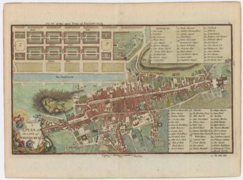
A late-18th century plan of Edinburgh
£350ANDREWS, John.
Published In 1800
Stock No. 23175 -

A two-sheet map of Lanarkshire in fine original colour
£2,000FORREST, William.
Published In 1818
Stock No. 22668 -

Southern Scotland from the first English Edition of the ‘Atlas Minor’
£120HONDIUS, Jodocus.
Published In 1635
Stock No. 22438 -

Northern Scotland from the first English Edition of the ‘Atlas Minor’
£150HONDIUS, Jodocus.
Published In 1635
Stock No. 22384 -

An early 17th century map of Scotland
£450QUAD, Matthias.
Published In 1608
Stock No. 22372 -

A 17th century townplan of Dover
£120HERMANNIDES, Rutger.
Published In 1661
Stock No. 22789 -

Early bird’s-eye map-view of Canterbury
£900BRAUN, Georg & HOGENBERG, Frans.
Published In 1588
Stock No. 22168 -

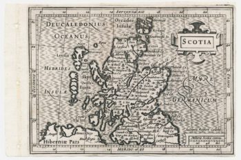
A scarce miniature map of Scotland
£160ROGIERS, Salomon.
Published In 1639
Stock No. 22089 -

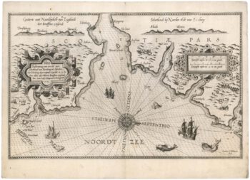
The First State of Waghenaer’s sea chart of south east Scotland
£3,500WAGHENAER, Lucas Janzoon.
Published In 1585
Stock No. 21772 -

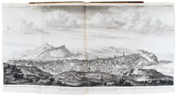
The earliest series of town prospects published in Britain
£6,500SLEZER, John.
Published In 1718
Stock No. 20013 -

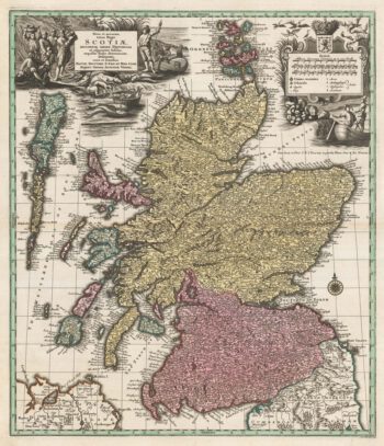
18th century map of Scotland
£750SEUTTER, Matthaus.
Published In 1742
Stock No. 19492 -

17th century plan of Edinburgh
£145MALLET, Alain Manesson.
Published In 1684
Stock No. 19406