Showing 37–46 of 46 results
-

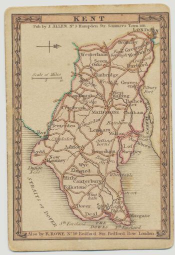
A scarce playing-card map of Kent
£500ALLEN, Joseph.
Published In 1811
Stock No. 18725 -

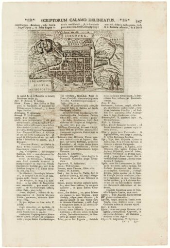
An early town plan of Edinburgh
£120VALEGIO, Francesco.
Published In 1713
Stock No. 18641 -

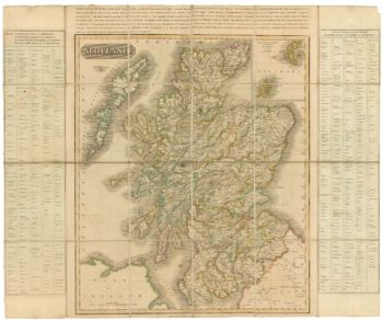
A scarce road map of Scotland
£725AINSLIE, John.
Published In 1790
Stock No. 18581 -

An unusual variant of Thomson’s map of Scotland
£420THOMSON, John.
Published In 1825
Stock No. 18578 -

Urban planning in Erith during the Age of the Railway
£600Anonymous.
Published In 1873
Stock No. 16089 -

Wall map of Scotland
£1,400CAMPBELL, Robert.
Published In 1794
Stock No. 16013 -

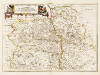
Map of Lower Clydesdale & the environs of Glasgow from the first atlas of Scotland
£380PONT, Timothy.
Published In 1654
Stock No. 14625 -
Map of Renfrewshire from the first atlas of Scotland
£350PONT, Timothy.
Published In 1662
Stock No. 14624 -

Sea chart of the Firth of Forth from the first English sea-atlas
£480COLLINS, Greenvile.
Published In 1750
Stock No. 14900 -

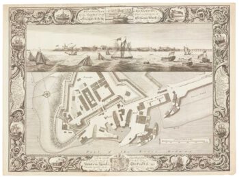
Fine plan of the naval dockyard at Sheerness, Kent
£600MILTON, Thomas.
Published In 1755
Stock No. 8492