Showing 13–24 of 122 results
-

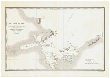
A detailed sea chart of the environs of Waitangi in New Zealand
£1,250DUPERREY, Louis-Isidore.
Published In 1829
Stock No. 23961 -

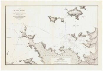
The first published chart of Macquarie Harbour in Tasmania
£1,200DUPERREY, Louis-Isidore.
Published In 1829
Stock No. 23960 -

A detailed sea chart of the environs of Manawaora in New Zealand
£1,200DUPERREY, Louis-Isidore.
Published In 1829
Stock No. 23959 -

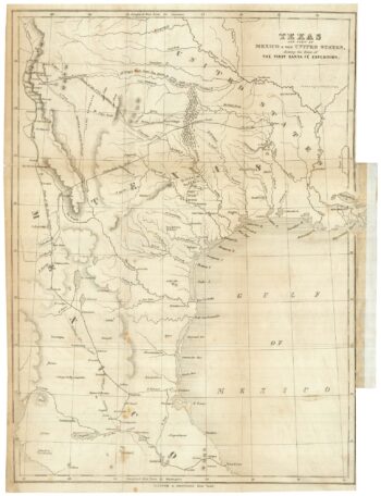
An account of the Texan Santa F? Expedition
£1,000KENDALL, George Wilkins.
Published In 1844
Stock No. 23853 -

A sought after map of the Republic of Texas
£1,200RADEFELD, Carl Christian Franz.
Published In 1846
Stock No. 23839 -

An 18th century map of New South Wales
£320WILKINSON, Robert.
Published In 1794
Stock No. 23692 -

The first published charts of Botany Bay and the Endeavour River
£400COOK, James.
Published In 1773
Stock No. 23669 -

Cook’s maps of Botany Bay and the Endeavour River
£180COOK, James.
Published In 1774
Stock No. 23585 -

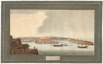
A rare 18th century view of Marsamxett
£3,750PULLICINO, Alberto.
Published In 1770
Stock No. 23426 -

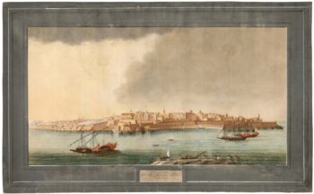
A rare 18th century view of Valletta
£3,750PULLICINO, Alberto.
Published In 1770
Stock No. 23425 -

One of the few maps showing the Republic of Texas
£750KENDALL, George Wilkins.
Published In 1844
Stock No. 23325 -

Early map of the roads from Lichfield to Chester
£280OGILBY, John.
Published In 1675
Stock No. 23239